Puerta Baja
Puerta Baja is a locality in Fernán-Núñez, Córdoba, Andalusia. Puerta Baja is situated nearby to the locality Puerta Alta, as well as near El Majuelo.| Tap on a place to explore it |
Places of Interest
Highlights include Ermita del Calvario and Palacio Ducal.


Places in the Area
Nearby places include Fernán Núñez and La Rambla.
Fernán Núñez
Town
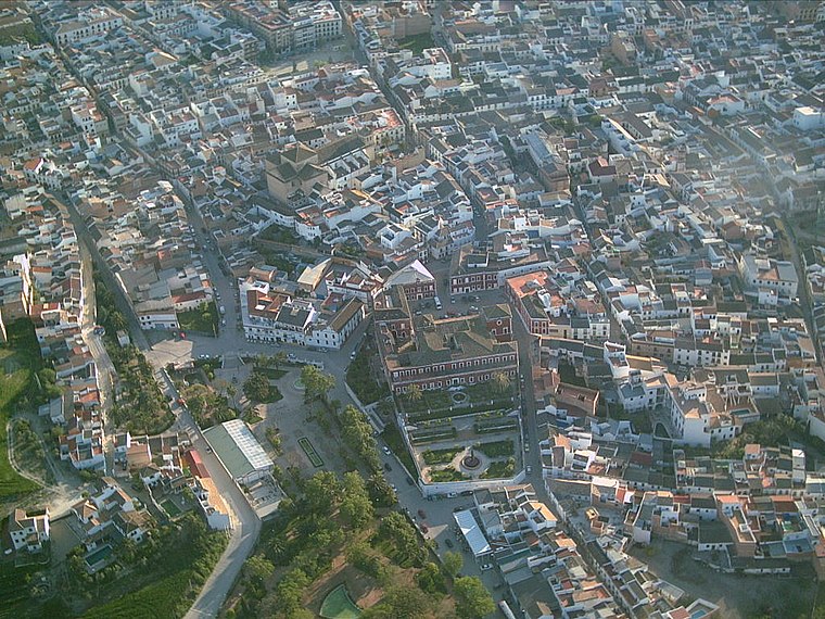
Photo: Wikimedia, CC BY-SA 3.0.
Fernán-Núñez is a municipality in the province of Córdoba, Spain. It is the host of the annual Caños Dorados Prize.
La Rambla
Village

Photo: Kallerna, CC BY-SA 4.0.
La Rambla is a municipality in the province of Córdoba, Spain. La Rambla is situated 7 km south of Puerta Baja.
San Sebastián de los Ballesteros
Village

Photo: 19Tarrestnom65, CC BY-SA 4.0.
San Sebastián de los Ballesteros is a municipality located in the province of Córdoba, Spain. According to the 2006 census, the city has a population of 836 inhabitants. San Sebastián de los Ballesteros is situated 7 km west of Puerta Baja.
Puerta Baja
- Type: Locality
- Location: Fernán-Núñez, Córdoba, Andalusia, Spain, Iberia, Europe
- View on OpenStreetMap
Latitude
37.66521° or 37° 39′ 55″ northLongitude
-4.74101° or 4° 44′ 28″ westOpen location code
8C9QM785+3HOpenStreetMap ID
node 1241938076OpenStreetMap feature
place=locality
This page is based on OpenStreetMap, Wikidata, and Wikimedia Commons.
We’d love your help improving our open data sources. Thank you for contributing.
Satellite Map
Discover Puerta Baja from above in high-definition satellite imagery.
Places with the Same Name
Discover other places named “Puerta Baja”.
Localities in the Area
Explore places such as Puerta Alta and El Majuelo.
Notable Places Nearby
Highlights include Pista de Atletismo and Polideportivo Municipal ‘Lucía Jiménez’.
Córdoba: Must-Visit Destinations
Delve into Córdoba, Puente Genil, and Iznájar.
Curious Localities to Discover
Uncover intriguing localities from every corner of the globe.
About Mapcarta. Data © OpenStreetMap contributors and available under the Open Database License". Text is available under the CC BY-SA 4.0 license, except for photos, directions, and the map. Photo: Mitch Vander Vorst, CC BY 2.0.