Camping de Keringa
Camping de Keringa is a campsite in Cléden-Cap-Sizun, Arrondissement of Quimper, Brittany. Camping de Keringa is situated nearby to the church Chapelle Saint-Trémeur de Cléden-Cap-Sizun.| Tap on a place to explore it |
Places of Interest Nearby
Highlights include Chapelle Saint-Trémeur de Cléden-Cap-Sizun and Chapelle Notre-Dame de Langroas.
Chapelle Saint-Trémeur de Cléden-Cap-Sizun
Church

Photo: Moreau.henri, CC BY-SA 4.0.
Chapelle Saint-Trémeur de Cléden-Cap-Sizun is a church, which is situated 770 metres west of Camping de Keringa.
Chapelle Notre-Dame de Langroas
Church

Photo: Moreau.henri, CC BY-SA 4.0.
Chapelle Notre-Dame de Langroas is a church, which is situated 1 km east of Camping de Keringa.
Église de Cléden-Cap-Sizun
Church
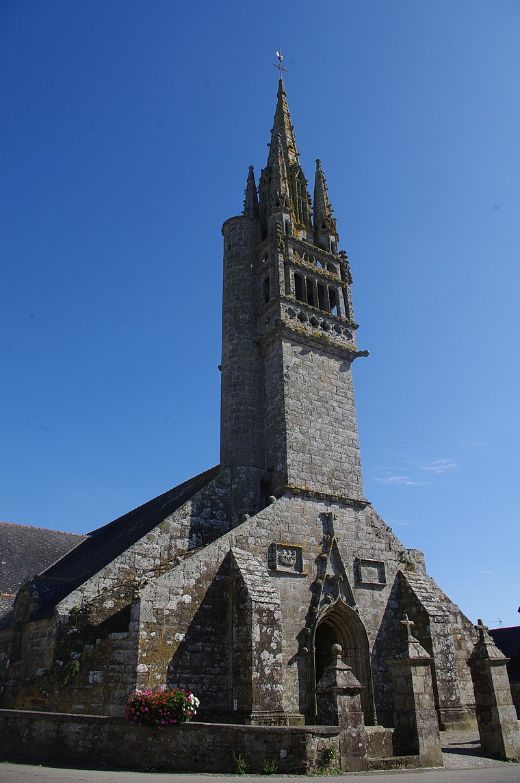
Photo: Tof29, CC BY-SA 3.0.
Église de Cléden-Cap-Sizun is a church, which is situated 1¼ km west of Camping de Keringa.
Camping de Keringa
- Type: Campsite
- Categories: tourism and camping
- Location: Cléden-Cap-Sizun, Arrondissement of Quimper, Finistère, Brittany, France, Europe
- View on OpenStreetMap
Latitude
48.04508° or 48° 2′ 42″ northLongitude
-4.63108° or 4° 37′ 52″ westOpen location code
8CWQ29W9+2HOpenStreetMap ID
node 12420505857OpenStreetMap feature
tourism=camp_site
This page is based on OpenStreetMap, Wikidata, and Wikimedia Commons.
We’d love your help improving our open data sources. Thank you for contributing.
Satellite Map
Discover Camping de Keringa from above in high-definition satellite imagery.
Notable Places Nearby
Highlights include Chapelle de Langroas and Mairie de Cléden-Cap-Sizun.
Nearby Places
Explore places such as Kernevez and Kerdiern ar Maner.
Brittany: Must-Visit Destinations
Delve into Rennes, Brest, Finistère, and Morbihan.
Curious Campsites to Discover
Uncover intriguing campsites from every corner of the globe.
About Mapcarta. Data © OpenStreetMap contributors and available under the Open Database License". Text is available under the CC BY-SA 4.0 license, except for photos, directions, and the map. Photo: Spendeau, CC BY-SA 3.0.