Loma de Bernarda
Loma de Bernarda is a locality in Alboloduy, Almería, Andalusia. Loma de Bernarda is situated nearby to the locality Llano de los Orientes, as well as near Majada Blanca.| Tap on a place to explore it |
Places of Interest
Highlights include Tabernas Desert and Homenaje a las víctimas del Caso Almería.
Tabernas Desert
Nature reserve
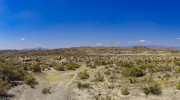 The Tabernas Desert is a desert located within Spain's south-eastern province of Almería. It is in the interior, about 30 kilometers north of the provincial capital Almería, in the Tabernas municipality in Andalusia.
Homenaje a las víctimas del Caso Almería
Memorial

Photo: Urci dream, CC BY-SA 4.0.
Homenaje a las víctimas del Caso Almería is a memorial, which is situated 3 km east of Loma de Bernarda.
Estación de Fuente Santa
Building

Photo: Wikimedia, CC BY-SA 4.0.
Estación de Fuente Santa is a building, which is situated 3½ km south of Loma de Bernarda.
Places in the Area
Nearby places include Gérgal and Las Aneas.
Gérgal
Village

Photo: Schumi4ever, CC BY-SA 3.0.
Gérgal is a municipality of Almería province, in the autonomous community of Andalusia, Spain. The town is located at the foot of the southern side of the Sierra de Los Filabres. Gérgal is situated 5 km north of Loma de Bernarda.
Las Aneas
Hamlet

Photo: MdeVicente, CC0.
Las Aneas is a hamlet, which is situated 8 km north of Loma de Bernarda.
Santa Cruz De Marchen
Village

Photo: Ismael Olea, CC BY 2.0.
Santa Cruz de Marchena is a municipality of Almería province, in the autonomous community of Andalusia, Spain. Santa Cruz De Marchen is situated 9 km southwest of Loma de Bernarda.
Loma de Bernarda
Latitude
37.0738° or 37° 4′ 26″ northLongitude
-2.52797° or 2° 31′ 41″ westOpen location code
8C9V3FFC+GROpenStreetMap ID
node 1242321134OpenStreetMap feature
place=locality
This page is based on OpenStreetMap, Wikidata, and Wikimedia Commons.
We’d love your help improving our open data sources. Thank you for contributing.
Satellite Map
Discover Loma de Bernarda from above in high-definition satellite imagery.
Localities in the Area
Explore places such as Llano de los Orientes and Majada Blanca.
Notable Places Nearby
Highlights include Castillo de Cerro Castellón and PR-A 310 Camino de la Loma de Tablas.
Almería: Must-Visit Destinations
Delve into Almería, Sierra Nevada, Roquetas de Mar, and Adra.
Curious Localities to Discover
Uncover intriguing localities from every corner of the globe.
About Mapcarta. Data © OpenStreetMap contributors and available under the Open Database License". Text is available under the CC BY-SA 4.0 license, except for photos, directions, and the map. Photo: isol, CC BY-SA 3.0.