Cerro de les Calderes
Cerro de les Calderes is a locality in Mas de las Matas Municipality, Teruel, Aragon. Cerro de les Calderes is situated nearby to the locality Cerro del Buitre, as well as near Planizas Umbrías.| Tap on a place to explore it |
Places of Interest
Highlights include Iglesia de San Juan Bautista.
Iglesia de San Juan Bautista
Church
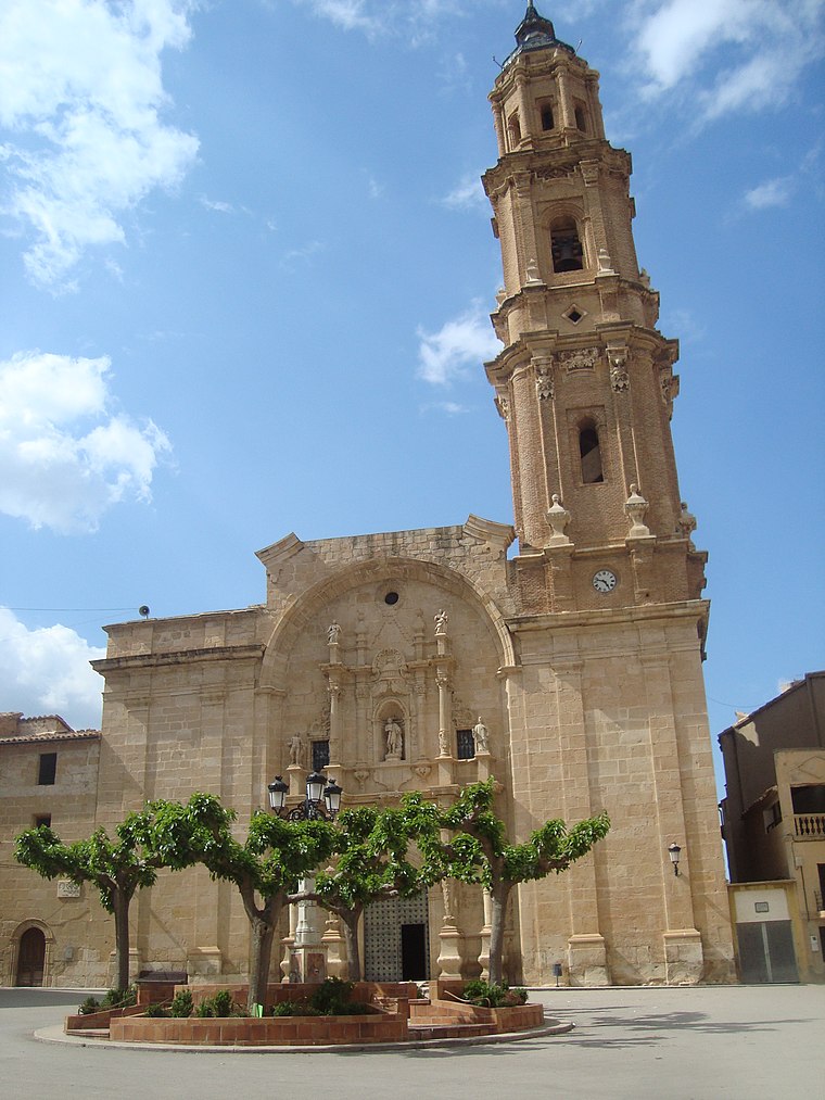
Photo: Juan Emilio Prades Bel, CC BY-SA 4.0.
Iglesia de San Juan Bautista is a church, which is situated 2½ km northwest of Cerro de les Calderes.
Places in the Area
Nearby places include Aguaviva Municipality and Las Parras de Castellote.
Aguaviva Municipality
Village

Photo: Arquitrabe, CC0.
Aguaviva or Aiguaviva de Bergantes is a municipality located in the province of Teruel, Aragon, Spain. According to the 2018 census, the municipality had a population of 522 inhabitants. Aguaviva Municipality is situated 3 km northeast of Cerro de les Calderes.
Las Parras de Castellote
Village

Photo: Javitrom 2018, CC BY-SA 4.0.
Las Parras de Castellote is a municipality located in the province of Teruel, Aragon, Spain. According to the 2004 census, the municipality has a population of 86 inhabitants. Las Parras de Castellote is situated 4 km south of Cerro de les Calderes.
Castellote Municipality
Village

Photo: CARLOS TEIXIDOR CADENAS, CC BY-SA 4.0.
Castellote is a municipality located in the province of Teruel, Aragon, Spain. According to the 2010 census, the municipality has a population of 804 inhabitants. Castellote Municipality is situated 8 km west of Cerro de les Calderes.
Cerro de les Calderes
- Type: Locality
- Location: Mas de las Matas Municipality, Teruel, Aragon, Northern Spain, Spain, Iberia, Europe
- View on OpenStreetMap
Latitude
40.81163° or 40° 48′ 42″ northLongitude
-0.22912° or 0° 13′ 45″ westOpen location code
8CGXRQ6C+M9OpenStreetMap ID
node 1242384932OpenStreetMap feature
place=locality
This page is based on OpenStreetMap, Wikidata, and Wikimedia Commons.
We’d love your help improving our open data sources. Thank you for contributing.
Satellite Map
Discover Cerro de les Calderes from above in high-definition satellite imagery.
In Other Languages
“Cerro de les Calderes” goes by many names.
- Catalan: “Cerro de les Calderes”
Localities in the Area
Explore places such as Cerro del Buitre and Les Calderes.
Notable Places Nearby
Highlights include Cementerio de Aguaviva and Frontón.
Aragon: Must-Visit Destinations
Delve into Zaragoza, Huesca, Teruel, and Calatayud.
Curious Localities to Discover
Uncover intriguing localities from every corner of the globe.
About Mapcarta. Data © OpenStreetMap contributors and available under the Open Database License". Text is available under the CC BY-SA 4.0 license, except for photos, directions, and the map. Photo: Javidlf, CC BY-SA 4.0.