A Pedra do Aire
A Pedra do Aire is a locality in Tui, Pontevedra, Galicia. A Pedra do Aire is situated nearby to the hamlet Saídes, as well as near A Marco da Fontenla.| Tap on a place to explore it |
Places of Interest
Highlights include Tui Station and Fortificações da Praça de Valença do Minho.
Tui Station
Railway station
 Tui Station is a railway station, which is situated 4 km northeast of A Pedra do Aire.
Fortificações da Praça de Valença do Minho
Historic site
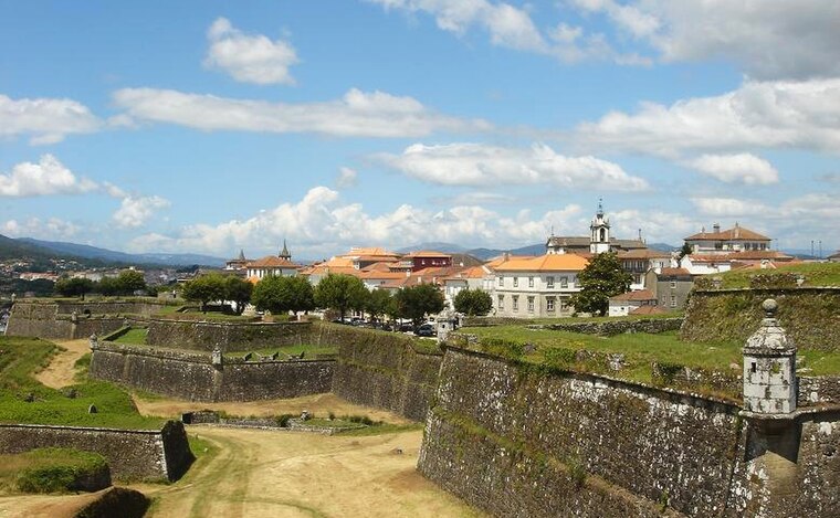
Photo: PQ3, CC BY-SA 3.0.
Fortificações da Praça de Valença do Minho is a historic site, which is situated 3½ km east of A Pedra do Aire.
Tui town hall
Town hall

Photo: Vivaelcelta, CC BY-SA 4.0.
Tui town hall is situated 3½ km east of A Pedra do Aire.
Places in the Area
Nearby places include O Tetón and Valença.
O Tetón
Locality

Photo: Chairego apc, CC BY 4.0.
O Tetón is a locality, which is situated 4 km northwest of A Pedra do Aire.
Valença

Photo: Sergei Gussev, CC BY 2.0.
Valença, also known as Valença do Minho, is a town and municipality in Portugal's Minho region. The town itself has 6,500 inhabitants. Valença lies on the Portuguese Way of St.
San Bartolomeu
Hamlet

Photo: Wikimedia, CC BY-SA 4.0.
San Bartolomeu is a hamlet, which is situated 4½ km east of A Pedra do Aire.
A Pedra do Aire
- Type: Locality
- Location: Tui, Pontevedra, Galicia, Green Spain, Spain, Iberia, Europe
- View on OpenStreetMap
Latitude
42.04302° or 42° 2′ 35″ northLongitude
-8.68713° or 8° 41′ 14″ westOpen location code
8CJH28V7+64OpenStreetMap ID
node 1242515206OpenStreetMap feature
place=locality
This page is based on OpenStreetMap, Wikidata, and Wikimedia Commons.
We’d love your help improving our open data sources. Thank you for contributing.
Satellite Map
Discover A Pedra do Aire from above in high-definition satellite imagery.
Localities in the Area
Explore places such as Saídes and A Marco da Fontenla.
Notable Places Nearby
Highlights include Mámoa de Seixos Albos and Equigalia Centro Ecuestre.
Galicia: Must-Visit Destinations
Delve into Santiago de Compostela, Lugo, Pontevedra, and A Coruña.
Curious Localities to Discover
Uncover intriguing localities from every corner of the globe.
About Mapcarta. Data © OpenStreetMap contributors and available under the Open Database License". Text is available under the CC BY-SA 4.0 license, except for photos, directions, and the map. Photo: Juantiagues, CC BY-SA 2.0.