Coma de s’Era
Coma de s’Era is a locality in Andratx, Balearic Islands. Coma de s’Era is situated nearby to the hamlet es Camp de Mar, as well as near the locality Comellar des Garrovers.| Tap on a place to explore it |
Places of Interest
Highlights include Torre de Cap Andritxol and Palmira beach.

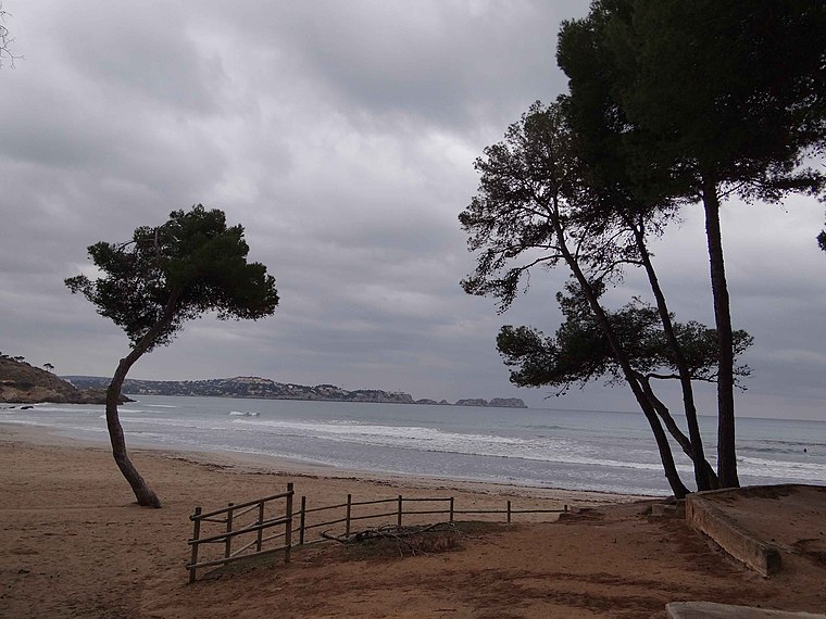
Platja de la Romana
Beach

Photo: Hihawai, CC BY-SA 3.0.
Platja de la Romana is a beach, which is situated 3 km east of Coma de s’Era.
Places in the Area
Nearby places include es Camp de Mar and Puig de Garrafa.
es Camp de Mar
Hamlet

Photo: Wikimedia, CC BY-SA 3.0.
Camp de Mar is a small resort village in the municipality of Andratx on the Spanish Balearic Island of Mallorca. The resort is 20 miles west of the island main airport of Son Sant Joan Airport. The resort's beach has been awarded a blue flag.
Puig de Garrafa
Locality

Photo: Wikimedia, CC BY-SA 3.0.
Puig de Garrafa is a locality, which is situated 3 km north of Coma de s’Era.
Coma de s’Era
- Type: Locality
- Location: Andratx, Balearic Islands, Spain, Iberia, Europe
- View on OpenStreetMap
Latitude
39.53882° or 39° 32′ 20″ northLongitude
2.42649° or 2° 25′ 35″ eastOpen location code
8FF4GCQG+GHOpenStreetMap ID
node 1242610995OpenStreetMap feature
place=locality
This page is based on OpenStreetMap, Wikidata, and Wikimedia Commons.
We’d love your help improving our open data sources. Thank you for contributing.
Satellite Map
Discover Coma de s’Era from above in high-definition satellite imagery.
In Other Languages
“Coma de s’Era” goes by many names.
- Catalan: “Coma de s’Era”
Localities in the Area
Explore places such as Comellar des Garrovers and Coma de s’Alemán.
Notable Places Nearby
Highlights include Ajuntament d’Andratx Oficina De Turisme and Sant Joaquim i Santa Aina.
Balearic Islands: Must-Visit Destinations
Delve into Palma de Mallorca, Formentera, Ibiza, and Maó.
Curious Localities to Discover
Uncover intriguing localities from every corner of the globe.
About Mapcarta. Data © OpenStreetMap contributors and available under the Open Database License". Text is available under the CC BY-SA 4.0 license, except for photos, directions, and the map. Photo: Tetra09, CC BY-SA 4.0.