Falda dets Ullastres
Falda dets Ullastres is a locality in Es Mercadal, Balearic Islands, Balearic Islands. Falda dets Ullastres is situated nearby to the locality Alzinar de sa Costa, as well as near Plans de Santa Eularieta.| Tap on a place to explore it |
Places of Interest
Highlights include El Toro and Monastery of the Toro Virgin.
El Toro
Peak
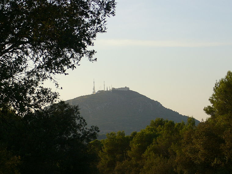
Photo: Gabriel Vidal, Public domain.
El Toro in Catalan, sometimes known by its Spanish name of Monte Toro, is the tallest hill of the island of Menorca, rising to an elevation of 358 m above mean sea level.
Monastery of the Toro Virgin
Church

Photo: Ben Salter, CC BY 2.0.
Monastery of the Toro Virgin is a church.
Claustre del Convent de Sant Diego
Square

Photo: Costapokemon, CC BY-SA 4.0.
Claustre del Convent de Sant Diego is a square, which is situated 4 km south of Falda dets Ullastres.
Places in the Area
Nearby places include Alaior and Es Migjorn Gran.
Alaior
Village

Photo: Paucabot, CC BY-SA 4.0.
Alaior is a municipality located in the eastern part of the island of Menorca, in the Balearic Islands, Spain. The municipality seat is situated 12 kilometres from the island's capital, Mahón. Alaior is situated 4 km south of Falda dets Ullastres.
Es Migjorn Gran
Village

Photo: Discasto, CC BY-SA 4.0.
Es Migjorn Gran is a small municipality in southern Menorca in the Spanish Balearic Islands. Formerly incorporated into the municipality of Es Mercadal, it is currently the island's newest and second-smallest municipal district. Es Migjorn Gran is situated 7 km west of Falda dets Ullastres.
Son Bou

Photo: Wasquewhat, CC BY-SA 4.0.
Son Bou is a small village of 165 people in the Alaior region of on the south coast of Menorca.
Falda dets Ullastres
- Type: Locality
- Location: Es Mercadal, Balearic Islands, Menorca, Balearic Islands, Spain, Iberia, Europe
- View on OpenStreetMap
Latitude
39.96703° or 39° 58′ 1″ northLongitude
4.12718° or 4° 7′ 38″ eastOpen location code
8FF6X48G+RVOpenStreetMap ID
node 1242631688OpenStreetMap feature
place=locality
This page is based on OpenStreetMap, Wikidata, and Wikimedia Commons.
We’d love your help improving our open data sources. Thank you for contributing.
Satellite Map
Discover Falda dets Ullastres from above in high-definition satellite imagery.
Localities in the Area
Explore places such as Alzinar de sa Costa and Plans de Santa Eularieta.
Notable Places Nearby
Highlights include Talaiot de Sa Roca. Es puig de s’ermita and Subaida Cheese.
Menorca: Must-Visit Destinations
Delve into Maó, Ciutadella, Cala Galdana, and Cala en Bosch.
Curious Localities to Discover
Uncover intriguing localities from every corner of the globe.
About Mapcarta. Data © OpenStreetMap contributors and available under the Open Database License". Text is available under the CC BY-SA 4.0 license, except for photos, directions, and the map. Photo: Nicolas G. Mertens, CC BY-SA 4.0.