Canteras de Górgolo
Canteras de Górgolo is a locality in Marina de Cudeyo, Cantabria. Canteras de Górgolo is situated nearby to the locality Islas de San Juan, as well as near Mortero.| Tap on a place to explore it |
Places of Interest
Highlights include Santander Airport and Isla de Pedrosa.
Santander Airport
Aerodrome
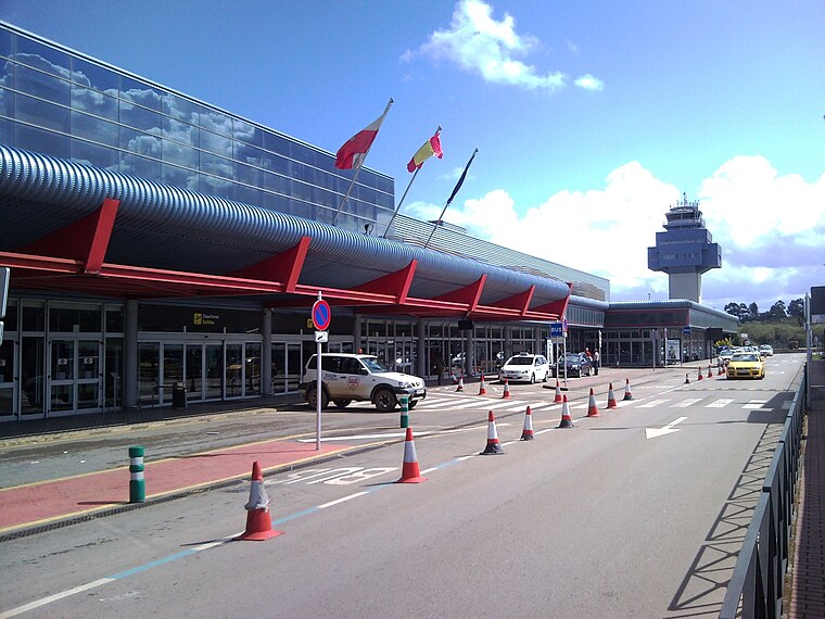
Photo: Tony Rotondas, CC BY 3.0.
Santander Airport, officially Seve Ballesteros–Santander Airport, is an international airport near Santander, Spain and the only airport in Cantabria. In 2018 the airport handled 1,103,353 passengers and 11,258 flights, far more than in 1995 when it handled only 180,000 passengers. Santander Airport is situated 2½ km west of Canteras de Górgolo.

Heras
Railway station

Photo: LMLM, CC BY-SA 3.0.
Heras is a railway station, which is situated 2½ km southeast of Canteras de Górgolo.
Places in the Area
Nearby places include Islas de San Juan and Pontejos.


Pedreña
Village

Photo: Luis Fermín TURIEL PEREDO, CC BY-SA 4.0.
Pedreña is a village in the municipality of Marina de Cudeyo, Cantabria, northern Spain. As of 2010, its population was 1,454. Although located 18 kilometres from Santander by road, it lies on a peninsula only about 2 kilometres across the bay from Santander, separated from land to the east by the mouth of the Miera River. Pedreña is situated 3 km northeast of Canteras de Górgolo.
Canteras de Górgolo
- Type: Locality
- Location: Marina de Cudeyo, Cantabria, Green Spain, Spain, Iberia, Europe
- View on OpenStreetMap
Latitude
43.41831° or 43° 25′ 6″ northLongitude
-3.78899° or 3° 47′ 20″ westOpen location code
8CMRC696+8COpenStreetMap ID
node 1242910085OpenStreetMap feature
place=locality
This page is based on OpenStreetMap, Wikidata, and Wikimedia Commons.
We’d love your help improving our open data sources. Thank you for contributing.
Satellite Map
Discover Canteras de Górgolo from above in high-definition satellite imagery.
Localities in the Area
Explore places such as Mortero and La Encina.
Notable Places Nearby
Highlights include Canteras de Górgolo and Tercera Isla.
Cantabria: Must-Visit Destinations
Delve into Santander, Santillana del Mar, Castro Urdiales, and Valles Pasiegos.
Curious Localities to Discover
Uncover intriguing localities from every corner of the globe.
About Mapcarta. Data © OpenStreetMap contributors and available under the Open Database License". Text is available under the CC BY-SA 4.0 license, except for photos, directions, and the map. Photo: Adbar, CC BY-SA 3.0.