Alto de la Royuela
Alto de la Royuela is a locality in La Puebla de Valverde Municipality, Teruel, Aragon. Alto de la Royuela is situated nearby to the locality Loma de la Royuela, as well as near Las Caídas.| Tap on a place to explore it |
Places in the Area
Nearby places include Valbona Municipality and La Puebla de Valverde.
Valbona Municipality
Village
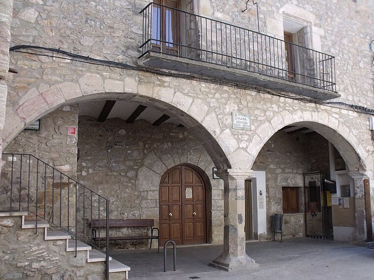
Photo: 19Tarrestnom65, CC BY-SA 4.0.
Valbona is a municipality located in the province of Teruel, Aragon, Spain. According to the 2004 census, the municipality had a population of 212 inhabitants. Valbona Municipality is situated 3½ km east of Alto de la Royuela.
La Puebla de Valverde
Village

Photo: Noeliaarnaug, CC BY-SA 3.0 es.
La Puebla de Valverde is a municipality located in the province of Teruel, Aragon, Spain. According to the 2004 census, the municipality had a population of 508 inhabitants. This town is located at the feet of the Sierra de Camarena, Sistema Ibérico. La Puebla de Valverde is situated 7 km west of Alto de la Royuela.
Mora de Rubielos Municipality
Village

Photo: Millars, CC BY-SA 3.0 es.
Mora de Rubielos is a municipality located in the mountainous area of the Iberian System, province of Teruel, Aragon, Spain. According to the 2009 census, the municipality has a population of 1,756 inhabitants. Mora de Rubielos Municipality is situated 9 km east of Alto de la Royuela.
Alto de la Royuela
- Type: Locality
- Location: La Puebla de Valverde Municipality, Teruel, Aragon, Northern Spain, Spain, Iberia, Europe
- View on OpenStreetMap
Latitude
40.2359° or 40° 14′ 9″ northLongitude
-0.8537° or 0° 51′ 13″ westOpen location code
8CGX64PW+9GOpenStreetMap ID
node 1243019226OpenStreetMap feature
place=locality
This page is based on OpenStreetMap, Wikidata, and Wikimedia Commons.
We’d love your help improving our open data sources. Thank you for contributing.
Satellite Map
Discover Alto de la Royuela from above in high-definition satellite imagery.
Localities in the Area
Explore places such as Las Caídas and Loma de la Royuela.
Notable Places Nearby
Highlights include Embalse Valbona Valbona and Ermita Nuestra Señora de Loreto.
Aragon: Must-Visit Destinations
Delve into Zaragoza, Huesca, Teruel, and Calatayud.
Curious Localities to Discover
Uncover intriguing localities from every corner of the globe.
About Mapcarta. Data © OpenStreetMap contributors and available under the Open Database License". Text is available under the CC BY-SA 4.0 license, except for photos, directions, and the map. Photo: Javidlf, CC BY-SA 4.0.