Los Turpines
Los Turpines is a locality in Archena, Murcia, Murcia. Los Turpines is situated nearby to the locality El Tamarit, as well as near Los Ramírez.| Tap on a place to explore it |
Places in the Area
Nearby places include Villanueva del Río Segura and Ulea.
Villanueva del Río Segura
Village

Photo: Lionni, Public domain.
Villanueva del Río Segura is a municipality in the Region of Murcia, Spain. Villanueva del Río Segura is situated 5 km southwest of Los Turpines.
Ulea
Village
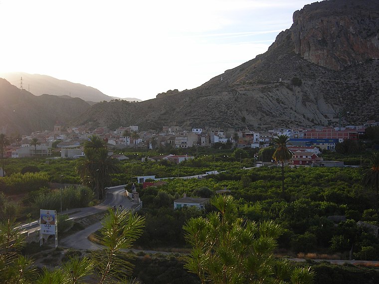
Photo: Sebasgs, CC BY-SA 4.0.
Ulea is a Spanish municipality in the autonomous community of Murcia. It has a population of 991 and an area of 40 km2. Ulea is situated 6 km west of Los Turpines.
Ojós
Village
Ojós is a municipality in the autonomous community of Murcia in southeastern Spain. It is located in the south-west of the north-eastern quarter of the region and has an area of 45.3 km 2 and shares borders with Blanca at its north, Ulea at its north-east, Villanueva del Río Segura at its East, Campos del Río at is south-west and Ricote at its north-west. Ojós is situated 6 km west of Los Turpines.
Los Turpines
- Type: Locality
- Location: Archena, Murcia, Murcia, Eastern Spain, Spain, Iberia, Europe
- View on OpenStreetMap
Latitude
38.15592° or 38° 9′ 21″ northLongitude
-1.27229° or 1° 16′ 20″ westOpen location code
8CCW5P4H+93OpenStreetMap ID
node 1243043697OpenStreetMap feature
place=locality
This page is based on OpenStreetMap, Wikidata, and Wikimedia Commons.
We’d love your help improving our open data sources. Thank you for contributing.
Satellite Map
Discover Los Turpines from above in high-definition satellite imagery.
Localities in the Area
Explore places such as El Tamarit and Los Ramírez.
Notable Places Nearby
Highlights include Cementerio de Archena and Parque Canino Archena.
Murcia: Must-Visit Destinations
Delve into Cartagena, Lorca, Caravaca de la Cruz, and La Manga.
Curious Localities to Discover
Uncover intriguing localities from every corner of the globe.
About Mapcarta. Data © OpenStreetMap contributors and available under the Open Database License". Text is available under the CC BY-SA 4.0 license, except for photos, directions, and the map. Photo: Tango7174, CC BY-SA 4.0.