Cañada del Morterete
Cañada del Morterete is a locality in Ceutí, Murcia, Murcia. Cañada del Morterete is situated nearby to the locality La Esparraguera, as well as near Loma Larga.| Tap on a place to explore it |
Places in the Area
Nearby places include Lorquí and Alguazas.
Lorquí
Town

Photo: Pedro J Pacheco, CC BY-SA 4.0.
Lorquí is a Spanish municipality in the autonomous community of Murcia. It has a population of 6,493 and an area of 15 km2. Lorquí is situated 3½ km northeast of Cañada del Morterete.
Alguazas
Town
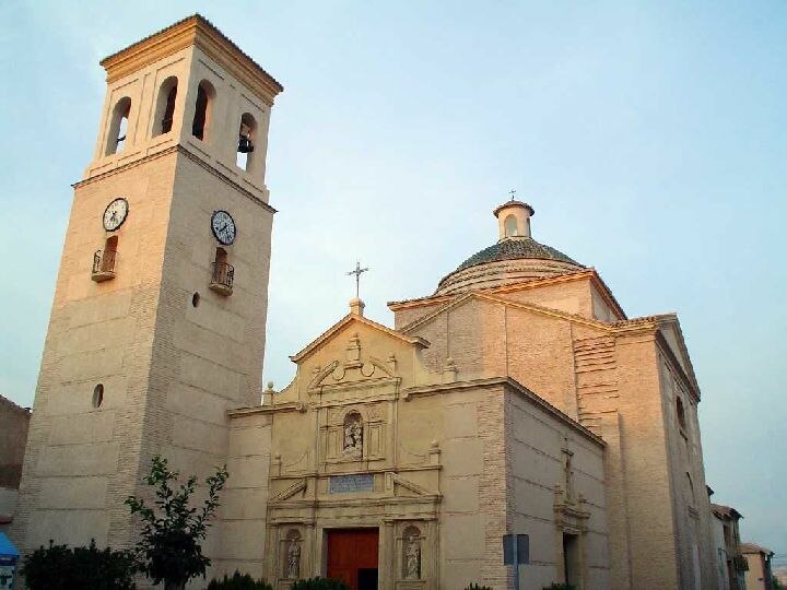
Photo: Julianalguazas, CC BY-SA 3.0.
Alguazas is a municipality of Spain in the autonomous community and province of Murcia and it is located in the south-west of the northeastern quarter. Alguazas is situated 4 km east of Cañada del Morterete.
Las Torres de Cotillas
Town

Photo: Jochosillo, CC BY-SA 3.0.
Las Torres de Cotillas is a Spanish municipality in the autonomous community of Murcia and is located in the eastern half. A Roman villa existed here in the 2nd century BC. Las Torres de Cotillas is situated 5 km southeast of Cañada del Morterete.
Cañada del Morterete
- Type: Locality
- Location: Ceutí, Murcia, Murcia, Eastern Spain, Spain, Iberia, Europe
- View on OpenStreetMap
Latitude
38.0615° or 38° 3′ 41″ northLongitude
-1.28705° or 1° 17′ 13″ westOpen location code
8CCW3P67+H5OpenStreetMap ID
node 1243076170OpenStreetMap feature
place=locality
This page is based on OpenStreetMap, Wikidata, and Wikimedia Commons.
We’d love your help improving our open data sources. Thank you for contributing.
Satellite Map
Discover Cañada del Morterete from above in high-definition satellite imagery.
Localities in the Area
Explore places such as La Esparraguera and Loma Larga.
Notable Places Nearby
Highlights include Campo fútbito and Cancha de basket.
Murcia: Must-Visit Destinations
Delve into Cartagena, Lorca, Caravaca de la Cruz, and La Manga.
Curious Localities to Discover
Uncover intriguing localities from every corner of the globe.
About Mapcarta. Data © OpenStreetMap contributors and available under the Open Database License". Text is available under the CC BY-SA 4.0 license, except for photos, directions, and the map. Photo: Tango7174, CC BY-SA 4.0.