Kitnasta glavica
Kitnasta glavica is a peak in Zadar County, Croatia and has an elevation of 286 metres. Kitnasta glavica is situated nearby to the hamlet Cičević, as well as near Modrič.| Tap on a place to explore it |
Places of Interest
Highlights include Kapelica Gospe Velebitske and Maslenica Bridge.
Kapelica Gospe Velebitske
Church

Photo: ferda.znojmo, CC BY 3.0.
Kapelica Gospe Velebitske is a church.
Maslenica Bridge
Bridge
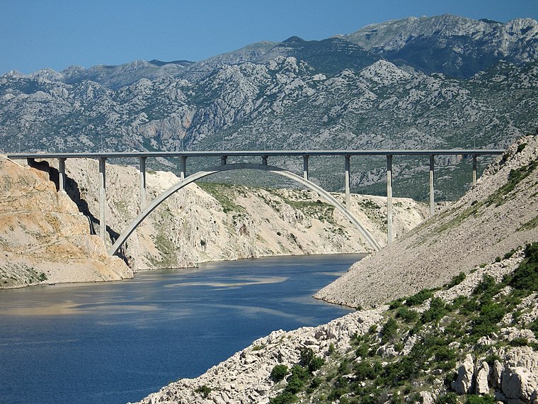
Photo: leprechaunhr, CC BY-SA 2.0.
Maslenica Bridge is a 377.6 m long reinforced concrete arch bridge spanning the Novsko Ždrilo strait of the Adriatic Sea, north of Zadar, Croatia, carrying the Croatian A1 motorway.
Places in the Area
Nearby places include Jasenice and Rovanjska.
Rovanjska
Village

Photo: LBM1948, CC BY-SA 4.0.
Rovanjska is a village in the Jasenice municipality of Zadar County, Croatia. It was not recorded as such in the 2011 census, which just had Jasenice as a single settlement.
Maslenica
Village

Photo: Ex13, CC BY-SA 3.0.
Maslenica is a village in the municipality of Jasenice in Zadar County, Dalmatia, Croatia. It is situated in Novigrad Sea. Waters are quite clear due to the Zrmanja river which flows into this gulf.
Kitnasta glavica
- Type: Peak with an elevation of 286 metres
- Category: landform
- Location: Zadar County, Croatia, Balkans, Europe
- View on OpenStreetMap
Latitude
44.2666° or 44° 15′ 60″ northLongitude
15.5599° or 15° 33′ 36″ eastElevation
286 metres (938 feet)Open location code
8FPQ7H85+JXOpenStreetMap ID
node 12431777212OpenStreetMap feature
natural=peak
This page is based on OpenStreetMap, Wikidata, and Wikimedia Commons.
We’d love your help improving our open data sources. Thank you for contributing.
Satellite Map
Discover Kitnasta glavica from above in high-definition satellite imagery.
Localities in the Area
Explore places such as Cičević and Modrič.
Notable Places Nearby
Highlights include Visoka glavica and Misarska glavica.
Croatia: Must-Visit Destinations
Delve into Zagreb, Dubrovnik, Split, and Rijeka.
Curious Peaks to Discover
Uncover intriguing peaks from every corner of the globe.
About Mapcarta. Data © OpenStreetMap contributors and available under the Open Database License". Text is available under the CC BY-SA 4.0 license, except for photos, directions, and the map. Photo: Wikimedia, CC BY-SA 3.0.