Le Pont du Régent
Le Pont du Régent is in Payzac, Arrondissement of Largentière, Auvergne-Rhône-Alpes. Le Pont du Régent is situated nearby to the church Église Saint-Pierre-aux-Liens de Payzac, as well as near Chapelle du Calvaire, Payzac.| Tap on a place to explore it |
Places of Interest Nearby
Highlights include Église Saint-Pierre-aux-Liens de Payzac and Chapelle du Calvaire, Payzac.
Église Saint-Pierre-aux-Liens de Payzac
Church
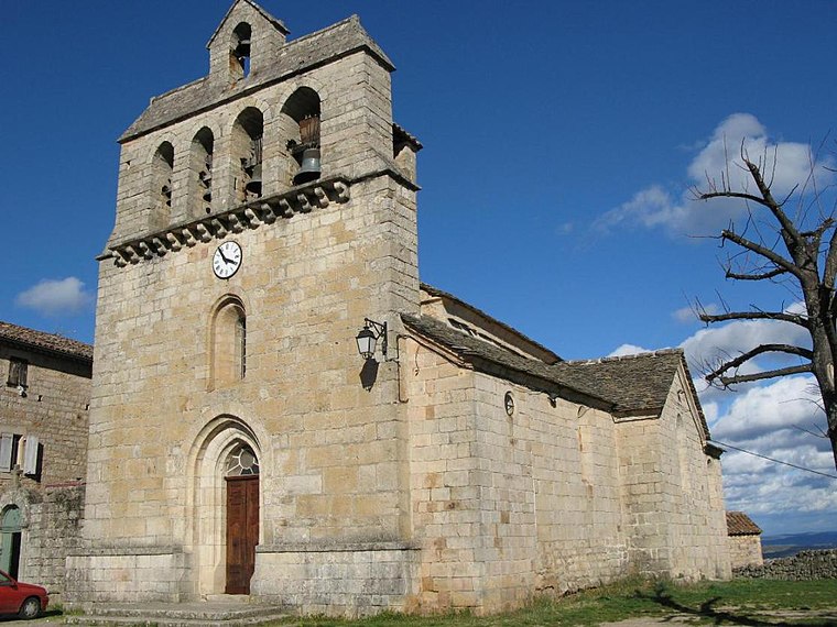
Photo: Raymondseneque, CC BY-SA 3.0.
Église Saint-Pierre-aux-Liens de Payzac is a church, which is situated 240 metres southwest of Le Pont du Régent.
Chapelle du Calvaire, Payzac
Chapel

Photo: Alainauzas, CC BY-SA 3.0.
Chapelle du Calvaire, Payzac is situated 280 metres southwest of Le Pont du Régent.
Église Saint-Théobald de Faugères
Church

Photo: Alainauzas, CC BY-SA 3.0.
Église Saint-Théobald de Faugères is a church, which is situated 3 km northwest of Le Pont du Régent.
Places in the Area
Nearby places include Saint-Genest-de-Beauzon and Lablachère.
Saint-Genest-de-Beauzon
Village

Photo: Raymondseneque, CC BY-SA 3.0.
Saint-Genest-de-Beauzon is a commune in the Ardèche department in southern France. Saint-Genest-de-Beauzon is situated 2½ km east of Le Pont du Régent.
Lablachère
Village

Photo: Patrice78500, CC BY-SA 3.0.
Lablachère is a commune in the Ardèche department in southern France. Lablachère is situated 4½ km east of Le Pont du Régent.
Les Vans
Village

Photo: Webspook, Public domain.
Les Vans is a commune in the Ardèche department in the Auvergne-Rhône-Alpes region of southern France. Les Vans is situated 6 km south of Le Pont du Régent.
Le Pont du Régent
- Type: Sign
- Categories: information and tourism
- Location: Payzac, Arrondissement of Largentière, Ardèche and Drôme, Auvergne-Rhône-Alpes, France, Europe
- View on OpenStreetMap
Latitude
44.45472° or 44° 27′ 17″ northLongitude
4.15574° or 4° 9′ 21″ eastElevation
295 metres (968 feet)Open location code
8FP6F534+V7OpenStreetMap ID
node 12434002359OpenStreetMap feature
tourism=information
This page is based on OpenStreetMap, Wikidata, and Wikimedia Commons.
We’d love your help improving our open data sources. Thank you for contributing.
Satellite Map
Discover Le Pont du Régent from above in high-definition satellite imagery.
Notable Places Nearby
Highlights include Mairie de Payzac and Place de l’Étouffoir.
Nearby Places
Explore places such as École primaire and L’Atelière.
Ardèche and Drôme: Must-Visit Destinations
Delve into Die, Vallon-Pont-d’Arc, Buis-les-Baronnies, and Lagorce.
Curious Places to Discover
Uncover intriguing places from every corner of the globe.
About Mapcarta. Data © OpenStreetMap contributors and available under the Open Database License". Text is available under the CC BY-SA 4.0 license, except for photos, directions, and the map. Photo: Perreal, CC BY-SA 3.0.