Eugenia Pickard
Eugenia Pickard is a memorial in Taylor, Texas. Eugenia Pickard is situated nearby to Stevenson Park, as well as near Diamond Lake.| Tap on a place to explore it |
Places of Interest Nearby
Highlights include Paramount Theatre and Hardin-Simmons University.
Paramount Theatre
Theater building
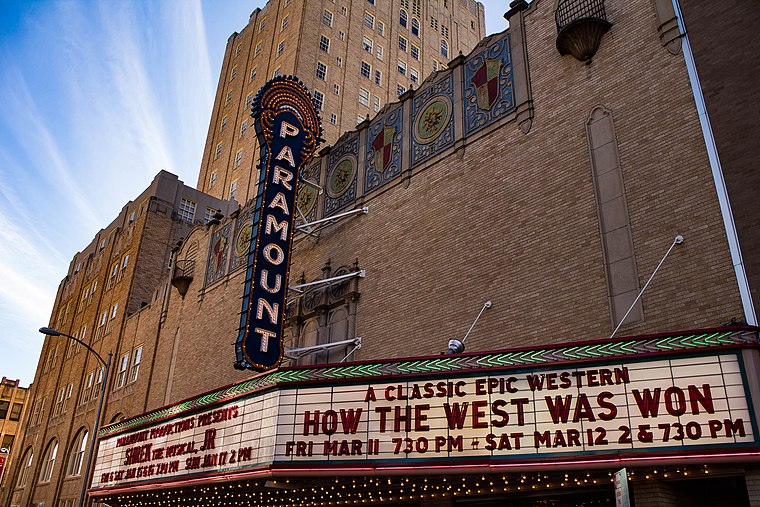
Photo: Renelibrary, CC BY-SA 4.0.
The Paramount Theatre is located in downtown Abilene, Texas at 352 Cypress Street. The Paramount was built in 1930 by H. O. Wooten, adjacent to his Hotel Wooten. Paramount Theatre is situated 1 mile west of Eugenia Pickard.
Hardin-Simmons University
University

Photo: Billy Hathorn, CC BY-SA 3.0.
Hardin–Simmons University is a private Baptist university in Abilene, Texas, United States. It is affiliated with the Baptist General Convention of Texas. Hardin-Simmons University is situated 2 miles northwest of Eugenia Pickard.
Shotwell Stadium
Stadium

Photo: Keithimus, CC BY-SA 3.0.
Shotwell Stadium is a stadium in Abilene, Texas. It was built in 1959, using Rice Stadium as a model. It was initially named the Public Schools Stadium. Shotwell Stadium is situated 1½ miles southeast of Eugenia Pickard.
Places in the Area
Nearby places include Abilene and Impact.
Abilene

Photo: Wikimedia, CC BY-SA 3.0.
Abilene is a city in the North Central Plains of Texas, possibly best known as the destination the fictional family of the Abilene paradox travels to.
Impact
Hamlet
Impact is a town in Taylor County, Texas, United States. The population was 22 as of the 2020 census, down from 35 at the 2010 census, making it the second least populated municipality in Texas. Impact is situated 3½ miles northwest of Eugenia Pickard.
Eugenia Pickard
- Type: Memorial
- Category: historic site
- Location: Taylor, Texas, United States, North America
- View on OpenStreetMap
Latitude
32.45229° or 32° 27′ 8″ northLongitude
-99.71683° or 99° 43′ 1″ westInception
2008Operator
Texas Historical CommissionOpen location code
8642F72M+W7OpenStreetMap ID
node 12453546675OpenStreetMap feature
historic=memorial
This page is based on OpenStreetMap, Wikidata, and Wikimedia Commons.
We’d love your help improving our open data sources. Thank you for contributing.
Satellite Map
Discover Eugenia Pickard from above in high-definition satellite imagery.
Notable Places Nearby
Highlights include Stevenson Park and Diamond Lake.
Nearby Places
Explore places such as Woodson Center for Excellence and The Oaks at Radford Hills.
Texas: Must-Visit Destinations
Delve into Houston, Austin, Dallas, and San Antonio.
Curious Memorials to Discover
Uncover intriguing memorials from every corner of the globe.
About Mapcarta. Data © OpenStreetMap contributors and available under the Open Database License". Text is available under the CC BY-SA 4.0 license, except for photos, directions, and the map. Photo: Wikimedia, CC0.