Fogo no Tacho
Fogo no Tacho is a café in Cedofeita, Ildefonso, Sé, Miragaia, Nicolau, Vitória, Porto. Fogo no Tacho is situated nearby to the sports venue Gimnoporto, as well as near the post office DHL.| Tap on a place to explore it |
Places of Interest Nearby
Highlights include Capela da Senhora da Boa Hora and Bolhão station.
Capela da Senhora da Boa Hora
Church

Photo: jad99, CC BY-SA 2.0.
Capela da Senhora da Boa Hora is a church, which is situated 150 metres northwest of Fogo no Tacho.
Bolhão station
Railway station

Photo: Ymblanter, CC BY-SA 4.0.
Bolhão is a light rail station on the Porto Metro system in Porto, Portugal. The station is underground, adjacent to the Bolhão Market, from which it takes its name. Bolhão station is situated 190 metres south of Fogo no Tacho.
Chapel of Santa Catarina
Church
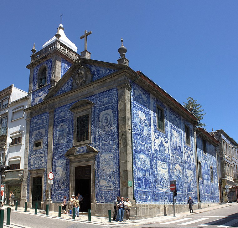
Photo: Nelson Rocha, CC BY 2.0.
The Chapel of Santa Catarina, also known as the Chapel of Souls, is a chapel located on the shopping street of Rua de Santa Catarina, in the former parish of Santo Ildefonso, in the city of Porto, in Portugal. Chapel of Santa Catarina is situated 180 metres south of Fogo no Tacho.
Places in the Area
Nearby places include Porto City Centre and Santo Ildefonso.
Porto City Centre
Neighborhood

Photo: Marcello Saponaro, CC BY 2.0.
Porto City Centre is a neighborhood.
Santo Ildefonso
Neighborhood

Photo: Wikimedia, CC BY-SA 3.0.
Santo Ildefonso is a former civil parish in the municipality of Porto, Portugal. In 2013, the parish merged into the new parish Cedofeita, Santo Ildefonso, Sé, Miragaia, São Nicolau e Vitória. The population in 2011 was 9,029, in an area of 1.24 km2.
Bonfim
Suburb

Photo: Henrique Matos, CC BY 2.5.
Bonfim is a Portuguese parish, located in the municipality of Porto. The population in 2011 was 24,265, in an area of 3.10 km².
Fogo no Tacho
Latitude
41.15141° or 41° 9′ 5″ northLongitude
-8.60507° or 8° 36′ 18″ westOpen location code
8CHH592V+HXOpenStreetMap ID
node 12453706932OpenStreetMap feature
amenity=cafe
This page is based on OpenStreetMap, Wikidata, and Wikimedia Commons.
We’d love your help improving our open data sources. Thank you for contributing.
Satellite Map
Discover Fogo no Tacho from above in high-definition satellite imagery.
Notable Places Nearby
Highlights include Gimnoporto and DHL.
Nearby Places
Explore places such as Casa Nun’Álvares and Frescas Tentações.
Portugal: Must-Visit Destinations
Delve into Lisbon, Caldas da Rainha, Coimbra, and Braga.
Curious Cafés to Discover
Uncover intriguing cafés from every corner of the globe.
About Mapcarta. Data © OpenStreetMap contributors and available under the Open Database License". Text is available under the CC BY-SA 4.0 license, except for photos, directions, and the map. Photo: Olegivvit, CC BY 2.5.