Der Hecht
Der Hecht is in Schliersee, Miesbach, Bavaria. Der Hecht is situated nearby to Ringmaier Boote, as well as near the police station Stolzenberghaus - Bayerische Bereitschaftspolizei.| Tap on a place to explore it |
Places of Interest Nearby
Highlights include Spitzingsee and St. Bernhard Spitzingsee.
Spitzingsee

Photo: Baumst, CC BY-SA 3.0.
Spitzingsee is a lake in Bavaria, Germany. At an elevation of 1084 m, its surface area is 28.3 hectares.
St. Bernhard Spitzingsee
Church
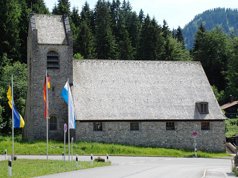
Photo: Rudolph Buch, CC0.
St. Bernhard Spitzingsee is a church, which is situated 430 metres east of Der Hecht.
Roßkopf
Scenic viewpoint
 The Roßkopf is a 1,580-metre-high peak in the Mangfall Mountains in Upper Bavaria. It lies in the south of the district of Miesbach right on the boundary between the parishes of Schliersee in the east and Rottach-Egern in the west, which forms the watershed between the lakes of Schliersee and Tegernsee. Roßkopf is situated 1½ km southwest of Der Hecht.
Places in the Area
Nearby places include Spitzingsee and Neuhaus.
Spitzingsee
Village
 Spitzingsee is a village within Marktgemeinde Schliersee which is part of Landkreis Miesbach, Bavaria, Germany. The population amounts to 200 plus tourists.
Neuhaus
Village

Photo: Wikimedia, CC BY-SA 3.0.
Neuhaus is a village, which is situated 4½ km north of Der Hecht.
Fischhausen (Schliersee)
Hamlet

Photo: Wikimedia, Public domain.
Fischhausen (Schliersee) is a hamlet, which is situated 6 km north of Der Hecht.
Der Hecht
- Type: Sign
- Categories: information and tourism
- Location: Schliersee, Miesbach, Upper Bavaria, Bavaria, Germany, Central Europe, Europe
- View on OpenStreetMap
Latitude
47.66153° or 47° 39′ 42″ northLongitude
11.88183° or 11° 52′ 55″ eastOpen location code
8FVHMV6J+JPOpenStreetMap ID
node 12497937997OpenStreetMap feature
tourism=information
This page is based on OpenStreetMap, Wikidata, and Wikimedia Commons.
We’d love your help improving our open data sources. Thank you for contributing.
Satellite Map
Discover Der Hecht from above in high-definition satellite imagery.
Places with the Same Name
Discover other places named “Der Hecht”.
Notable Places Nearby
Highlights include Ringmaier Boote and Stolzenberghaus - Bayerische Bereitschaftspolizei.
Nearby Places
Explore places such as Der See and Sportalm ESV-Neuaubing.
Upper Bavaria: Must-Visit Destinations
Delve into Munich, Ingolstadt, Dachau, and Rosenheim.
Curious Places to Discover
Uncover intriguing places from every corner of the globe.
About Mapcarta. Data © OpenStreetMap contributors and available under the Open Database License". Text is available under the CC BY-SA 4.0 license, except for photos, directions, and the map. Photo: Tbp386, CC BY-SA 3.0.