Heueggliberg
Heueggliberg is a locality in St. Stephan, Obersimmental-Saanen, Canton of Bern. Heueggliberg is situated nearby to the hamlet Stalde, as well as near Zil.| Tap on a place to explore it |
Places of Interest
Highlights include Spillgerte and Rauflihorn.
Spillgerte
Peak

Photo: Waldteufel78, CC BY-SA 4.0.
The Spillgerte is a mountain of the Bernese Alps, located east of Zweisimmen in the Bernese Oberland. The mountain lies between the valleys of Diemtigen and Simmental, a few kilometres north of the Albristhorn.
Rauflihorn
Scenic viewpoint
The Rauflihorn is a mountain of the Bernese Alps, located east of St. Stephan in the Bernese Oberland, Switzerland. Rauflihorn is situated 3½ km east of Heueggliberg.
St. Stephan railway station
Railway station
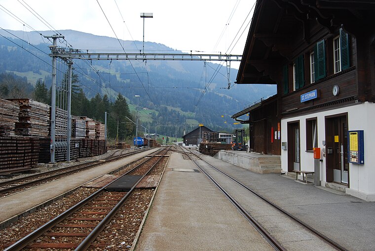
Photo: DidiWeidmann, CC BY-SA 3.0.
St. Stephan railway station is a railway station in the municipality of St. Stephan, in the Swiss canton of Bern. It is an intermediate stop on the 1,000 mm Montreux–Lenk im Simmental line of the Montreux Oberland Bernois Railway. St. Stephan railway station is situated 4 km southwest of Heueggliberg.
Places in the Area
Nearby places include Zweisimmen and Lenk im Simmental.
Zweisimmen
Village

Photo: Gürbetaler, CC BY-SA 4.0.
Zweisimmen is a municipality in the Obersimmental-Saanen administrative district in the canton of Bern in Switzerland. Zweisimmen is situated 6 km northwest of Heueggliberg.
Lenk im Simmental
Village

Photo: Wikimedia, CC BY-SA 3.0.
Lenk im Simmental is a municipality in the Obersimmental-Saanen administrative district in the canton of Bern in Switzerland. Lenk im Simmental is situated 8 km south of Heueggliberg.
Adelboden
Village

Photo: Barbe-sauvage, CC0.
Adelboden is a mountain village and a municipality in Switzerland, located in the Frutigen-Niedersimmental administrative district in the Bernese Highlands. Adelboden is situated 10 km southeast of Heueggliberg.
Heueggliberg
- Type: Locality
- Location: St. Stephan, Obersimmental-Saanen, Canton of Bern, Switzerland, Central Europe, Europe
- View on OpenStreetMap
Latitude
46.52716° or 46° 31′ 38″ northLongitude
7.43917° or 7° 26′ 21″ eastOpen location code
8FR9GCGQ+VMOpenStreetMap ID
node 12500331837OpenStreetMap feature
place=locality
This page is based on OpenStreetMap, Wikidata, and Wikimedia Commons.
We’d love your help improving our open data sources. Thank you for contributing.
Satellite Map
Discover Heueggliberg from above in high-definition satellite imagery.
Localities in the Area
Explore places such as Heueggli and Stalde.
Notable Places Nearby
Highlights include Chörbelihore and Wolfsgrätli.
Switzerland: Must-Visit Destinations
Delve into Zurich, Berne, Geneva, and Basel.
Curious Localities to Discover
Uncover intriguing localities from every corner of the globe.
About Mapcarta. Data © OpenStreetMap contributors and available under the Open Database License". Text is available under the CC BY-SA 4.0 license, except for photos, directions, and the map. Photo: Simonizer, CC BY-SA 2.0 de.