Celtics
Celtics is a fountain in La Flèche, Sarthe, Pays de la Loire. Celtics is situated nearby to the fountain Tradi, as well as near the swimming pool Piscine de la Templerie.| Tap on a place to explore it |
Places of Interest Nearby
Highlights include Carmes Castle and Salle Coppélia.
Carmes Castle
Castle

Photo: Manfred Heyde, CC BY-SA 4.0.
Carmes Castle is a building located in La Flèche in the Sarthe department. Established as a fortress in the mid-11th century, it was transformed by the Carmelites in the 17th century, who set up their convent there, and then became a private dwelling after the Revolution. Carmes Castle is situated 1 km southwest of Celtics.
Salle Coppélia
Theater building
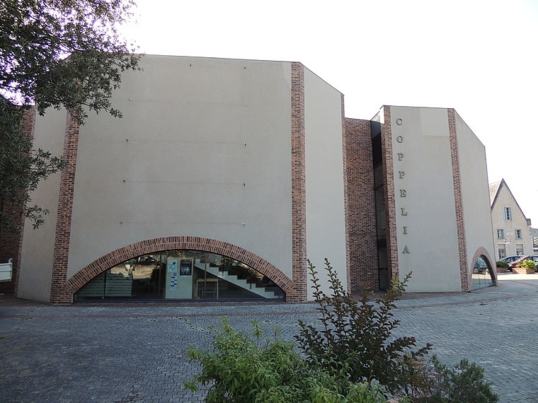
Photo: HubertduMaine, CC BY-SA 3.0.
Salle Coppélia is a theater building, which is situated 1 km west of Celtics.
Église Sainte-Colombe de La Flèche
Church

Photo: Skouame, CC BY-SA 3.0.
Église Sainte-Colombe de La Flèche is a church, which is situated 1 km south of Celtics.
Places in the Area
Nearby places include La Flèche and Cré-sur-Loir.
La Flèche
Town

Photo: Skouame, CC BY-SA 3.0.
La Flèche is a town and commune in the French department of Sarthe, in the Pays de la Loire region in the Loire Valley. It is the sub-prefecture of the South-Sarthe, the chief district and the chief city of a canton, and the second most populous city of the department.
Cré-sur-Loir
Village
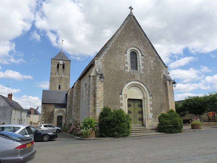
Photo: Wikimedia, CC BY-SA 3.0.
Cré-sur-Loir is a former commune in the Sarthe department in the Pays de la Loire region in north-western France. On 1 January 2017, it was merged into the new commune Bazouges Cré sur Loir. Its population was 758 in 2022. Cré-sur-Loir is situated 8 km west of Celtics.
Clefs
Village

Photo: Skouame, CC BY-SA 3.0.
Clefs is a former commune in the Maine-et-Loire department in western France. In January 2013 it merged with Vaulandry to form the commune of Clefs-Val d'Anjou, which merged into the commune Baugé-en-Anjou on 1 January 2016. Its population was 1,064 in 2022. Clefs is situated 8 km south of Celtics.
Celtics
- Type: Fountain
- Location: La Flèche, Arrondissement of La Flèche, Sarthe, Pays de la Loire, France, Europe
- View on OpenStreetMap
Latitude
47.69988° or 47° 41′ 60″ northLongitude
-0.06271° or 0° 3′ 46″ westOpen location code
8CVXMWXP+XWOpenStreetMap ID
node 12522768053OpenStreetMap feature
amenity=fountain
This page is based on OpenStreetMap, Wikidata, and Wikimedia Commons.
We’d love your help improving our open data sources. Thank you for contributing.
Satellite Map
Discover Celtics from above in high-definition satellite imagery.
Notable Places Nearby
Highlights include Tradi and Piscine de la Templerie.
Nearby Places
Explore places such as Prytanée (Quartier Gallieni) and Préau de la Termplerie.
Pays de la Loire: Must-Visit Destinations
Delve into Montsoreau, Nantes, Angers, and Le Mans.
Curious Fountains to Discover
Uncover intriguing fountains from every corner of the globe.
About Mapcarta. Data © OpenStreetMap contributors and available under the Open Database License". Text is available under the CC BY-SA 4.0 license, except for photos, directions, and the map. Photo: Crochet.david, CC BY-SA 3.0.