Kępno railway station
Kępno is a railway station in Kępno, Poland run by PKP, the Polish State Railways.| Tap on a place to explore it |
Photo: Axe, CC BY-SA 4.0.
- Type: Railway station
- Description: railway station in Kępno, Poland
- Also known as: “Kępno”
Places of Interest Nearby
Highlights include Intermarché and Kępno town hall.
Intermarché
Supermarket

Photo: Marcel Roblin, CC BY-SA 4.0.
Intermarché is a brand of general commercial hypermarkets, supermarkets and convenience stores owned by French retail group Les Mousquetaires. It mainly operates in France, French-speaking Belgium, Poland and Portugal. Intermarché is situated 1½ km southwest of Kępno railway station.
Kępno town hall
Town hall

Photo: SMilejski, CC BY-SA 3.0 pl.
Kępno town hall is situated 1½ km southwest of Kępno railway station.
Orlen
Gas station
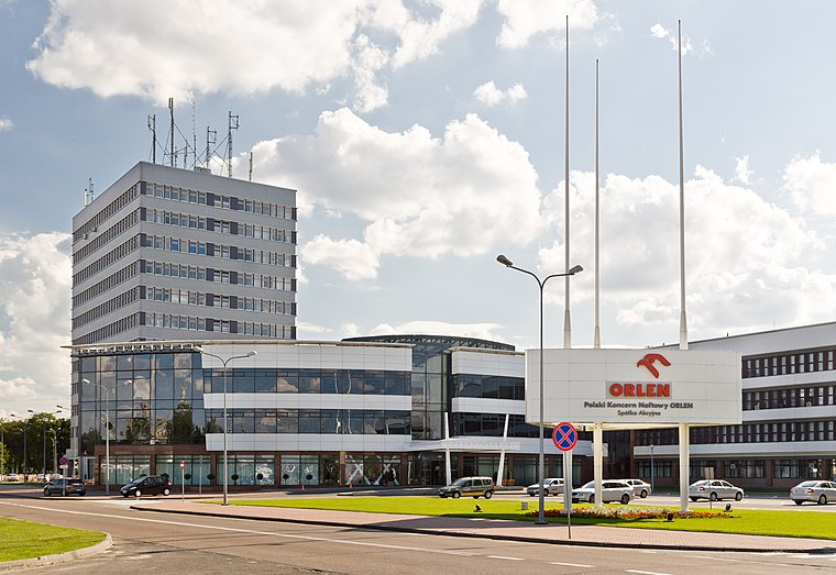
Photo: CLI, CC BY-SA 3.0 pl.
Orlen S.A, commonly known as Orlen, is a Polish multinational oil refiner, petrol retailer and natural gas trader headquartered in Płock, Poland. The company's subsidiaries include the main oil and gas companies of the Czech Republic and Lithuania, Unipetrol and Orlen Lietuva, respectively. Orlen is situated 1¼ km southwest of Kępno railway station.
Places in the Area
Nearby places include Krążkowy and Biały Młyn.
Krążkowy
Village
Krążkowy is a village in the administrative district of Gmina Kępno, within Kępno County, Greater Poland Voivodeship, in west-central Poland.
Biały Młyn
Hamlet
Biały Młyn is a village in the administrative district of Gmina Kępno, within Kępno County, Greater Poland Voivodeship, in west-central Poland.
Kępno
Town
Photo: SMilejski, CC BY-SA 3.0 pl.
Kępno is a town in south-central Poland. Kępno is located in the historical Wieluń Land. It lies on the outskirts of the Greater Poland Voivodeship, bordering the historical region of Silesia and the Łódź Voivodeship.
Kępno railway station
- Categories: multi-level interchange railway station, station, and transportation
- Location: Gmina Kępno, Kępno County, Wielkopolskie, Poland, Central Europe, Europe
- View on OpenStreetMap
Latitude
51.29195° or 51° 17′ 31″ northLongitude
18.00141° or 18° 0′ 5″ eastOperator
PKP Polskie Linie KolejoweNetwork
Polregio;PKP IntercityOpen location code
9F3W72R2+QHOpenStreetMap ID
node 12529059962OpenStreetMap feature
public_transport=stationOpenStreetMap feature
railway=stationWikidata ID
Q2553279
This page is based on OpenStreetMap, Wikidata, Wikimedia Commons, and Wikipedia.
We’d love your help improving our open data sources. Thank you for contributing.
Satellite Map
Discover Kępno railway station from above in high-definition satellite imagery.
In Other Languages
From Dutch to Polish—“Kępno railway station” goes by many names.
- Dutch: “Station Kepno”
- Dutch: “station Kępno”
- Dutch: “Station Kępno”
- French: “gare de Kępno”
- French: “Kępno”
- Polish: “Kępno”
Notable Places Nearby
Highlights include Dworzec PKP Kępno and Kościół pw. Matki Bożej Różańcowej w Kępnie.
Nearby Places
Explore places such as Kępno and Kępno.
Wielkopolskie: Must-Visit Destinations
Delve into Poznań, Gniezno, Kalisz, and Ostrów Wielkopolski.
Curious Railway Stations to Discover
Uncover intriguing railway stations from every corner of the globe.
About Mapcarta. Data © OpenStreetMap contributors and available under the Open Database License". Text is available under the CC BY-SA 4.0 license, except for photos, directions, and the map. Description text is based on the Wikipedia page “Kępno railway station”. Photo: Axe, CC BY-SA 4.0.