Oxytim Maroc
Oxytim Maroc is an office in Casablanca, North Atlantic Coast which is located on Rue du Parc. Oxytim Maroc is situated nearby to the museum Musée de la Fondation Abderrahman slaoui, as well as near the government office Agence Urbaine de Casablanca الوكالة الحضرية للدار البيضاء.| Tap on a place to explore it |
Places of Interest Nearby
Highlights include Casablanca Cathedral and United Nations Square.
Casablanca Cathedral
Church
The Casablanca Cathedral, or Church of the Sacred Heart, is a former church located in Casablanca, Morocco. Casablanca Cathedral is situated 290 metres southwest of Oxytim Maroc.
United Nations Square
Square

Photo: Wikimedia, Public domain.
United Nations Square is a public square in the center of Casablanca, Morocco. It has been central in the history of Casablanca. United Nations Square is situated 400 metres northeast of Oxytim Maroc.
Beth El Synagogue
Synagogue
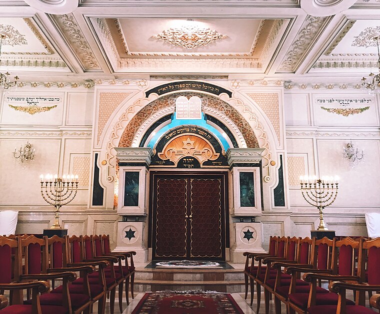
Photo: Sambasoccer27, CC BY-SA 4.0.
The Temple Beth-El is an Orthodox Jewish congregation and synagogue, located at 67 Rue Jaber ben Hayane, in the Sidi Belyout district of Casablanca, Morocco. Beth El Synagogue is situated 530 metres northwest of Oxytim Maroc.
Places in the Area
Nearby places include Gauthier and Medina of Casablanca.


Oxytim Maroc
- Type: Insurance company
- Address: Rue du Parc, Casablanca
- Category: office
- Location: Casablanca, Casablanca-Settat, North Atlantic Coast, Morocco, North Africa, Africa
- View on OpenStreetMap
Latitude
33.59296° or 33° 35′ 35″ northLongitude
-7.62221° or 7° 37′ 20″ westOpen location code
8C5JH9VH+54OpenStreetMap ID
node 12529593090OpenStreetMap feature
office=insurance
This page is based on OpenStreetMap, Wikidata, and Wikimedia Commons.
We’d love your help improving our open data sources. Thank you for contributing.
Satellite Map
Discover Oxytim Maroc from above in high-definition satellite imagery.
Notable Places Nearby
Highlights include Musée de la Fondation Abderrahman slaoui and Agence Urbaine de Casablanca الوكالة الحضرية للدار البيضاء.
Nearby Places
Explore places such as Auto-école Raki Barka and Restaurant Rouget de l’Isle.
North Atlantic Coast: Must-Visit Destinations
Delve into Rabat, El Jadida, Larache, and Asilah.
Curious Places to Discover
Uncover intriguing places from every corner of the globe.
About Mapcarta. Data © OpenStreetMap contributors and available under the Open Database License". Text is available under the CC BY-SA 4.0 license, except for photos, directions, and the map. Photo: elchicogris, CC BY-SA 2.0.