Cré@vallée Sud
Cré@vallée Sud is a quarter in Sanilhac, Arrondissement of Périgueux, Nouvelle-Aquitaine. Cré@vallée Sud is situated nearby to the locality Peyrinet, as well as near the quarter Cré@vallée Nord.| Tap on a place to explore it |
Places of Interest
Highlights include Église Notre-Dame-de-la-Nativité and Église Saint-Michel de Coulounieix.
Église Notre-Dame-de-la-Nativité
Church

Photo: Père Igor, CC BY-SA 3.0.
Église Notre-Dame-de-la-Nativité is a church.
Église Saint-Michel de Coulounieix
Church

Photo: Père Igor, CC BY-SA 4.0.
Église Saint-Michel de Coulounieix is a church, which is situated 2½ km north of Cré@vallée Sud.
Château de la Rolphie
Castle
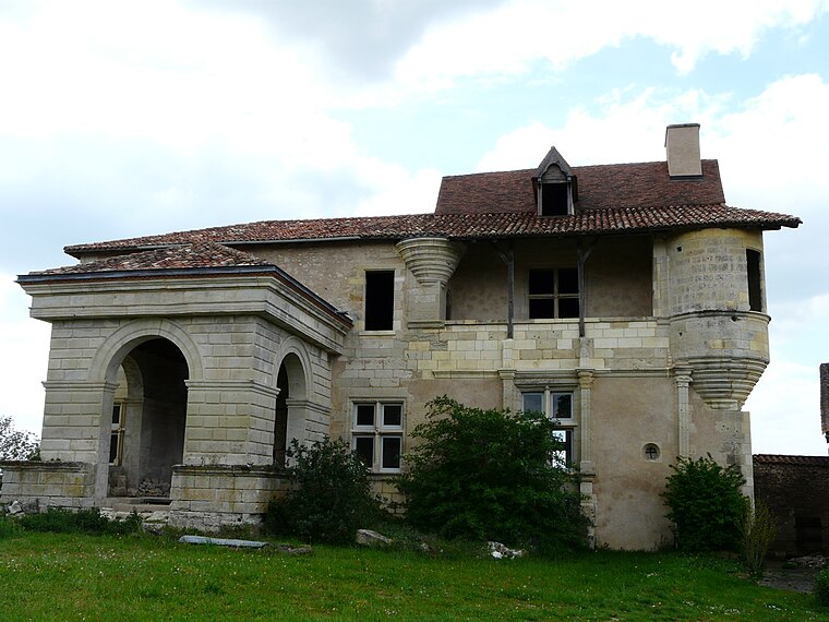
Photo: Père Igor, CC BY-SA 3.0.
Château de la Rolphie is a castle, which is situated 3½ km northwest of Cré@vallée Sud.
Places in the Area
Nearby places include Atur and Périgueux.
Atur
Village

Photo: Père Igor, CC BY-SA 3.0.
Atur is a former commune in the Dordogne department in southwestern France. On 1 January 2016, it was merged into the new commune Boulazac Isle Manoire. Atur is situated 4 km east of Cré@vallée Sud.
Périgueux

Photo: Père Igor, CC BY-SA 3.0.
Périgueux is a commune in the Dordogne department, in the administrative region of Nouvelle-Aquitaine, southwestern France. Périgueux is the prefecture of Dordogne, and the capital city of Périgord. It is also the seat of a Roman Catholic diocese.
Coulounieix-Chamiers
Village

Photo: Père Igor, CC BY-SA 3.0.
Coulounieix-Chamiers is a commune in the Dordogne department in Nouvelle-Aquitaine in southwestern France. It is a suburb of Périgueux. Coulounieix-Chamiers is situated 6 km north of Cré@vallée Sud.
Cré@vallée Sud
- Type: Quarter
- Category: locality
- Location: Sanilhac, Arrondissement of Périgueux, Dordogne, Nouvelle-Aquitaine, France, Europe
- View on OpenStreetMap
Latitude
45.13547° or 45° 8′ 8″ northLongitude
0.70014° or 0° 42′ 1″ eastOpen location code
8FQ24PP2+53OpenStreetMap ID
node 12533772705OpenStreetMap feature
place=quarter
This page is based on OpenStreetMap, Wikidata, and Wikimedia Commons.
We’d love your help improving our open data sources. Thank you for contributing.
Satellite Map
Discover Cré@vallée Sud from above in high-definition satellite imagery.
Localities in the Area
Explore places such as Peyrinet and Cré@vallée Nord.
Notable Places Nearby
Highlights include Keep Cool and Douanes.
Dordogne: Must-Visit Destinations
Delve into Périgueux, Sarlat-la-Canéda, Bergerac, and Rocamadour.
Curious Quarters to Discover
Uncover intriguing quarters from every corner of the globe.
About Mapcarta. Data © OpenStreetMap contributors and available under the Open Database License". Text is available under the CC BY-SA 4.0 license, except for photos, directions, and the map. Photo: Sémhur, CC BY-SA 3.0.