São Miguel (JF)
São Miguel (JF) is a bus stop in St. Tirso, Couto (S. Cristina e S. Miguel) e Burgães, Santo Tirso Municipality, Porto District. São Miguel (JF) is situated nearby to the town hall Junta de Freguesia Couto - S. Miguel, as well as near the suburb Burgães.| Tap on a place to explore it |
Places of Interest Nearby
Highlights include Câmara Municipal de Santo Tirso and Santo Tirso train station.
Câmara Municipal de Santo Tirso
Town hall

Photo: Vitor Oliveira, CC BY-SA 2.0.
Câmara Municipal de Santo Tirso is a town hall, which is situated 1½ km northwest of São Miguel (JF).
Santo Tirso train station
Railway station

Photo: Wikimedia, Public domain.
Santo Tirso train station is a railway station, which is situated 2 km northwest of São Miguel (JF).
Santo Tirso Monastery
Church
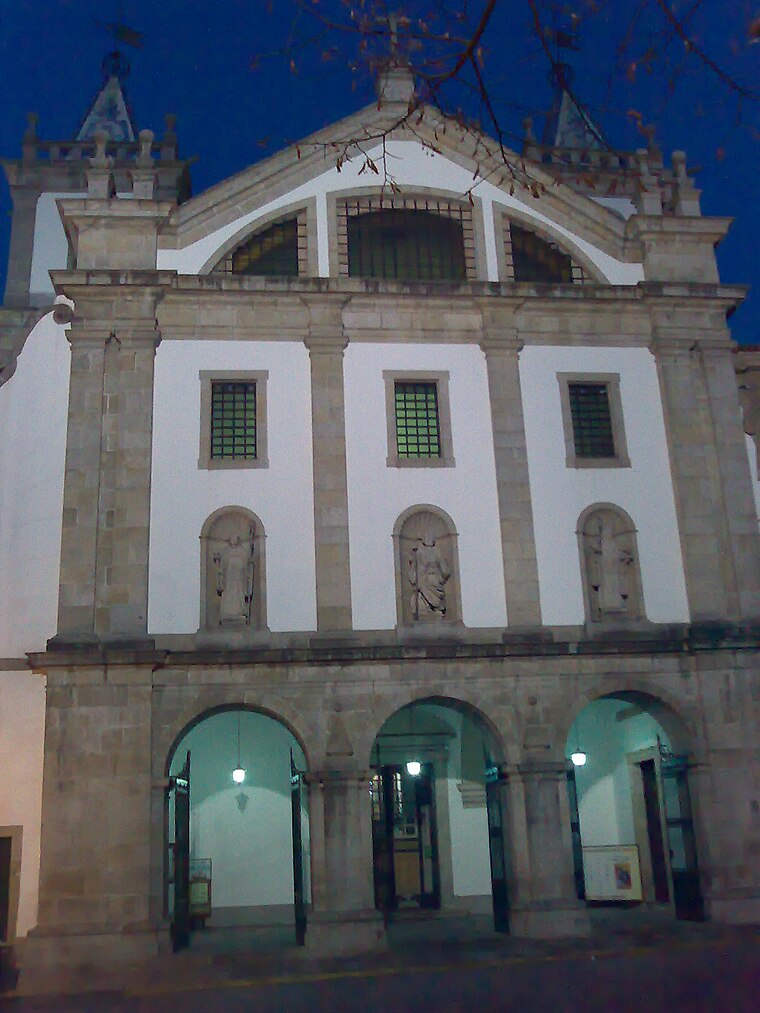
Photo: Adriao, CC BY-SA 4.0.
Monastery of Santo Tirso is a monastery located in the parish of Santo Tirso, municipality of Santo Tirso, in Portugal, that was of the Benedictine Order. Santo Tirso Monastery is situated 1½ km northwest of São Miguel (JF).
Places in the Area
Nearby places include Couto and Burgães.
Couto
Suburb
São Miguel do Couto is a former civil parish in the municipality of Santo Tirso, Portugal. In 2013, the parish merged into the new parish Santo Tirso, Couto e Burgães.
Burgães
Suburb
Burgães is a former civil parish in the municipality of Santo Tirso, Portugal. In 2013, the parish merged into the new parish of Santo Tirso, Couto e Burgães.
Couto
Suburb
Couto Santa Cristina is a former civil parish in the municipality of Santo Tirso, Portugal. In 2013, the parish merged into the new parish Santo Tirso, Couto e Burgães.
São Miguel (JF)
- Type: Bus stop
- Category: transportation
- Location: St. Tirso, Couto (S. Cristina e S. Miguel) e Burgães, Santo Tirso Municipality, Porto District, Portugal, Iberia, Europe
- View on OpenStreetMap
Latitude
41.33202° or 41° 19′ 55″ northLongitude
-8.46248° or 8° 27′ 45″ westOperator
TransdevNetwork
TransdevOpen location code
8CHH8GJQ+R2OpenStreetMap ID
node 12542782491OpenStreetMap feature
highway=bus_stopOpenStreetMap feature
public_transport=platform
This page is based on OpenStreetMap, Wikidata, and Wikimedia Commons.
We’d love your help improving our open data sources. Thank you for contributing.
Satellite Map
Discover São Miguel (JF) from above in high-definition satellite imagery.
Notable Places Nearby
Highlights include Junta de Freguesia Couto - S. Miguel and Parque do Ribeiro do Matadouro.
Nearby Places
Explore places such as São Miguel (JF) and Padre Gonzaga Pinheiro 1.
Portugal: Must-Visit Destinations
Delve into Lisbon, Caldas da Rainha, Porto, and Coimbra.
Curious Bus Stops to Discover
Uncover intriguing bus stops from every corner of the globe.
About Mapcarta. Data © OpenStreetMap contributors and available under the Open Database License". Text is available under the CC BY-SA 4.0 license, except for photos, directions, and the map. Photo: Tsy1980, CC BY-SA 4.0.