Kaltentalweiher
Kaltentalweiher is in Bad Urach, Reutlingen, Baden-Württemberg. Kaltentalweiher is situated nearby to the pond Kohlteichweiher, as well as near the scenic viewpoint Lauereckfels.| Tap on a place to explore it |
Places of Interest Nearby
Highlights include Falkensteiner Cave and Grabenstetten airfield.
Falkensteiner Cave
Cave

Photo: Holger Gruber, CC BY-SA 2.0 de.
Falkensteiner Cave is situated 2 km east of Kaltentalweiher.
Grabenstetten airfield
Aerodrome

Photo: Carsten Steger, CC BY-SA 4.0.
Grabenstetten airfield is an aerodrome.
Schloss Urach
Castle

Photo: Misburg3014, CC BY-SA 3.0.
Schloss Urach is a castle, which is situated 3½ km southwest of Kaltentalweiher.
Places in the Area
Nearby places include Hülben and Konradfels.

Konradfels
Locality
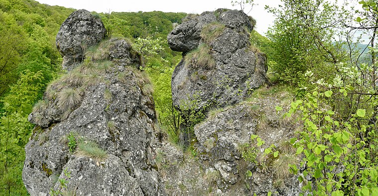
Photo: Ramessos, CC BY-SA 3.0.
Konradfels is a locality, which is situated 4 km northeast of Kaltentalweiher.
Neuffen
Town

Photo: Wikimedia, CC BY-SA 3.0.
Neuffen is a town, which is situated 6 km northwest of Kaltentalweiher.
Kaltentalweiher
- Type: Sign
- Categories: information and tourism
- Location: Bad Urach, Reutlingen, Tübingen Region, Baden-Württemberg, Germany, Central Europe, Europe
- View on OpenStreetMap
Latitude
48.51637° or 48° 30′ 59″ northLongitude
9.42507° or 9° 25′ 30″ eastElevation
557 metres (1,827 feet)Operator
Bad UrachOpen location code
8FWFGC8G+G2OpenStreetMap ID
node 12571488267OpenStreetMap feature
highway=emergency_access_pointOpenStreetMap feature
tourism=information
This page is based on OpenStreetMap, Wikidata, and Wikimedia Commons.
We’d love your help improving our open data sources. Thank you for contributing.
Satellite Map
Discover Kaltentalweiher from above in high-definition satellite imagery.
Notable Places Nearby
Highlights include Kohlteichweiher and Lauereckfels.
Nearby Places
Explore places such as Kaltental and Siegfried Palmer.
Baden-Württemberg: Must-Visit Destinations
Delve into Stuttgart, Heidelberg, Karlsruhe, and Mannheim.
Curious Places to Discover
Uncover intriguing places from every corner of the globe.
About Mapcarta. Data © OpenStreetMap contributors and available under the Open Database License". Text is available under the CC BY-SA 4.0 license, except for photos, directions, and the map. Photo: Traveler100, CC BY-SA 3.0.