Waldhütte Lengnau
Waldhütte Lengnau is a wilderness hut in Lengnau, Zurzach District, Canton of Aargau. Waldhütte Lengnau is situated nearby to the peak Hörndli, as well as near the village Freienwil.| Tap on a place to explore it |
Places of Interest Nearby
Highlights include Lengnau synagogue and Roman catholic parish church.
Lengnau synagogue
Synagogue

Photo: Ikiwaner, CC BY-SA 3.0.
Lengnau synagogue is situated 2 km east of Waldhütte Lengnau.
Roman catholic parish church
Church
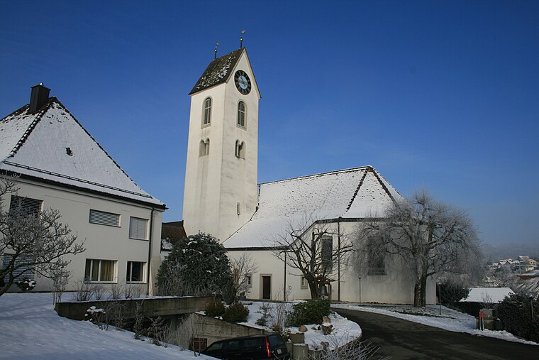
Photo: Badener, CC BY-SA 3.0.
Roman catholic parish church is situated 1½ km east of Waldhütte Lengnau.
Jüdischer Friedhof Endingen
Cemetery

Photo: Wikimedia, CC BY-SA 4.0.
Jüdischer Friedhof Endingen is the oldest and largest Jewish cemetery in Switzerland, situated in the Surb Valley in the Canton of Aargau. The cemetery is listed in Swiss inventory of cultural property of national significance. Jüdischer Friedhof Endingen is situated 2 km north of Waldhütte Lengnau.
Places in the Area
Nearby places include Lengnau and Freienwil.
Lengnau
Village

Photo: Wikimedia, CC BY-SA 3.0.
Lengnau is a municipality in the district of Zurzach in the canton of Aargau in Switzerland. It is notable for being one of two villages where residence was permitted for Swiss Jews between 1633 and 1874.
Freienwil
Village
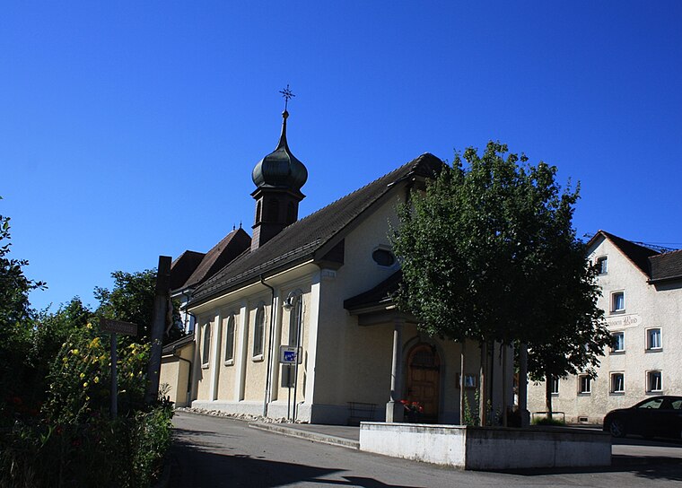
Photo: Badener, CC BY-SA 3.0.
Freienwil is a municipality in the district of Baden in the canton of Aargau in Switzerland.
Endingen
Village

Photo: Wikimedia, CC BY-SA 3.0.
Endingen is a municipality in the district of Zurzach in the canton of Aargau in Switzerland. In the 18th and 19th century, Endingen was one of few villages in which Swiss Jews were permitted to settle. Endingen is situated 2½ km northwest of Waldhütte Lengnau.
Waldhütte Lengnau
- Type: Wilderness hut
- Categories: tourism, accommodation, and building
- Location: Lengnau, Zurzach District, Canton of Aargau, Switzerland, Central Europe, Europe
- View on OpenStreetMap
Latitude
47.51599° or 47° 30′ 58″ northLongitude
8.30775° or 8° 18′ 28″ eastOpen location code
8FVCG885+94OpenStreetMap ID
node 12578667563OpenStreetMap feature
tourism=wilderness_hut
This page is based on OpenStreetMap, Wikidata, and Wikimedia Commons.
We’d love your help improving our open data sources. Thank you for contributing.
Satellite Map
Discover Waldhütte Lengnau from above in high-definition satellite imagery.
Notable Places Nearby
Highlights include Anna-Kapelle and Dorfmuseum.
Nearby Places
Explore places such as Plattenhof and Forsthaus Freienwil.
Switzerland: Must-Visit Destinations
Delve into Zurich, Berne, Geneva, and Basel.
Curious Wilderness Huts to Discover
Uncover intriguing wilderness huts from every corner of the globe.
About Mapcarta. Data © OpenStreetMap contributors and available under the Open Database License". Text is available under the CC BY-SA 4.0 license, except for photos, directions, and the map. Photo: Simonizer, CC BY-SA 2.0 de.