Klaeranlage Wenslingen
Klaeranlage Wenslingen is in Basel-Landschaft, Switzerland. Klaeranlage Wenslingen is situated nearby to the cave Bruderloch, as well as near the waterfall Wasserfall Wasserflue.| Tap on a place to explore it |
Places of Interest Nearby
Highlights include Village square fountain and Ruins Ödenburg.
Village square fountain
Fountain

Photo: Roland Zumbuehl, CC BY 3.0.
Village square fountain is situated 450 metres east of Klaeranlage Wenslingen.
Ruins Ödenburg
Archaeological site

Photo: Wikimedia, Public domain.
Ruins Ödenburg is an archaeological site, which is situated 1 km northwest of Klaeranlage Wenslingen.
Tecknau railway station
Railway station
 Tecknau railway station is a railway station in the municipality of Tecknau, in the Swiss canton of Basel-Landschaft. It is an intermediate stop on the base tunnel branch of the standard gauge Hauenstein line of Swiss Federal Railways. Tecknau railway station is situated 1½ km northwest of Klaeranlage Wenslingen.
Places in the Area
Nearby places include Wenslingen and Kilchberg.
Wenslingen
Village

Photo: Roland Zumbuehl, CC BY 3.0.
Wenslingen is a municipality in the district of Sissach in the canton of Basel-Country in Switzerland.
Kilchberg
Village
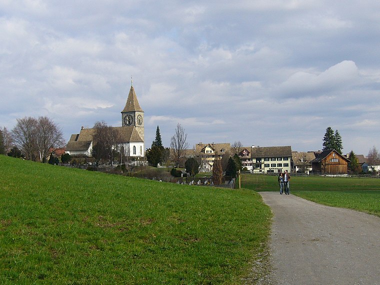
Photo: Wikimedia, CC BY-SA 3.0.
Kilchberg is a municipality in the district of Sissach in the canton of Basel-Country in Switzerland.
Rünenberg
Village

Photo: DidiWeidmann, CC BY-SA 3.0.
Rünenberg is a municipality in the district of Sissach in the canton of Basel-Country in Switzerland.
Klaeranlage Wenslingen
- Type: Sign
- Categories: information and tourism
- Location: Basel-Landschaft, Switzerland, Central Europe, Europe
- View on OpenStreetMap
Latitude
47.43896° or 47° 26′ 20″ northLongitude
7.90443° or 7° 54′ 16″ eastOpen location code
8FV9CWQ3+HQOpenStreetMap ID
node 1258075105OpenStreetMap feature
tourism=information
This page is based on OpenStreetMap, Wikidata, and Wikimedia Commons.
We’d love your help improving our open data sources. Thank you for contributing.
Satellite Map
Discover Klaeranlage Wenslingen from above in high-definition satellite imagery.
Notable Places Nearby
Highlights include Bruderloch and Wasserfall Wasserflue.
Nearby Places
Explore places such as Buech and Altes Primarschulhaus.
Switzerland: Must-Visit Destinations
Delve into Zurich, Berne, Geneva, and Basel.
Curious Places to Discover
Uncover intriguing places from every corner of the globe.
About Mapcarta. Data © OpenStreetMap contributors and available under the Open Database License". Text is available under the CC BY-SA 4.0 license, except for photos, directions, and the map. Photo: Simonizer, CC BY-SA 2.0 de.