La Capellanía
La Capellanía is a suburb in Oliva, La, Las Palmas. La Capellanía is situated nearby to the suburb Geafond, as well as near the locality El Jable - Las Dunas de Corralejo.| Tap on a place to explore it |
Places of Interest
Highlights include Calderón Hondo.

Places in the Area
Nearby places include Corralejo.
Corralejo
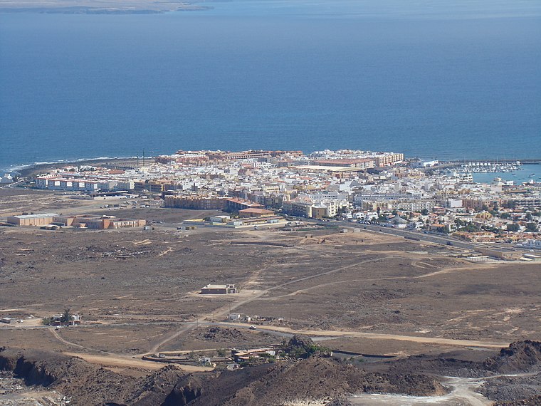
Photo: Andy Mitchell, CC BY-SA 2.0.
Corralejo is a beach-town on the northern tip of Fuerteventura. It is known for its vacation resorts, beaches, and as with the rest of the island, strong winds.
La Capellanía
- Type: Suburb
- Category: locality
- Location: Oliva, La, Las Palmas, Canary Islands, Spain, Iberia, Europe
- View on OpenStreetMap
Latitude
28.69596° or 28° 41′ 46″ northLongitude
-13.89167° or 13° 53′ 30″ westOpen location code
7CW8M4W5+98OpenStreetMap ID
node 12585616123OpenStreetMap feature
place=suburb
This page is based on OpenStreetMap, Wikidata, and Wikimedia Commons.
We’d love your help improving our open data sources. Thank you for contributing.
Satellite Map
Discover La Capellanía from above in high-definition satellite imagery.
Places with the Same Name
Discover other places named “La Capellanía”.
Localities in the Area
Explore places such as Geafond and El Jable - Las Dunas de Corralejo.
Notable Places Nearby
Highlights include Morros de Bayuyo and Caldera Encantada.
Canary Islands: Must-Visit Destinations
Delve into Santa Cruz de Tenerife, Las Palmas, La Palma, and La Gomera.
Curious Suburbs to Discover
Uncover intriguing suburbs from every corner of the globe.
About Mapcarta. Data © OpenStreetMap contributors and available under the Open Database License". Text is available under the CC BY-SA 4.0 license, except for photos, directions, and the map. Photo: Wikimedia, CC BY-SA 4.0.