Conditorei-Pastisserie Glaubach
Conditorei-Pastisserie Glaubach is a pâtisserie in Bensheim, Bergstraße, Hesse. Conditorei-Pastisserie Glaubach is situated nearby to the government office Bürgerbüro, as well as near the theater building PiPaPo-Kellertheater.| Tap on a place to explore it |
- Opening hours:
Monday: closed
Tuesday—Friday: 9:00 AM—6:00 PM
Saturday: 8:30 AM—4:00 PM
Sunday: noon—6:00 PM - Email: info@conditorei-glaubach.de
- Type: Pâtisserie
Places of Interest Nearby
Highlights include Hospitalkirche St. Joseph and Bensheim station.
Hospitalkirche St. Joseph
Church

Photo: Kuebi, CC BY-SA 3.0.
Hospitalkirche St. Joseph is a church, which is situated 180 metres south of Conditorei-Pastisserie Glaubach.
Bensheim station
Railway station
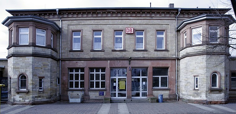
Photo: Wikimedia, CC BY-SA 3.0.
Bensheim station is in the town of Bensheim on the Main-Neckar Railway, connecting Frankfurt and Heidelberg, in the German state of Hesse. The station is also the beginning and end of the single-track non-electrified Worms–Bensheim line. Bensheim station is situated 350 metres west of Conditorei-Pastisserie Glaubach.
St. George (Bensheim)
Church

Photo: Leithian, CC BY-SA 3.0.
St. George (Bensheim) is a church, which is situated 200 metres northeast of Conditorei-Pastisserie Glaubach.
Places in the Area
Nearby places include Unter-Hambach and Heppenheim.
Unter-Hambach
Neighborhood

Photo: Kuebi, CC BY-SA 3.0.
Unter-Hambach is a neighborhood, which is situated 4 km southeast of Conditorei-Pastisserie Glaubach.
Heppenheim

Photo: Berthold Werner, CC BY-SA 3.0.
Heppenheim is a town in South Hesse, Germany along the Bergstraße, a mountain road running on the western edge of the Odenwald mountain range.
Schwanheim
Village

Photo: Kuebi, CC BY-SA 3.0.
Schwanheim is a village, which is situated 4½ km northwest of Conditorei-Pastisserie Glaubach.
Conditorei-Pastisserie Glaubach
- Categories: shop and food
- Location: Bensheim, Bergstraße, South Hesse, Hesse, Germany, Central Europe, Europe
- View on OpenStreetMap
Latitude
49.68049° or 49° 40′ 50″ northLongitude
8.62174° or 8° 37′ 18″ eastOperator
Christina GlaubachOpen location code
8FXCMJJC+5MOpenStreetMap ID
node 12601894495OpenStreetMap feature
shop=pastry
This page is based on OpenStreetMap, Wikidata, and Wikimedia Commons.
We’d love your help improving our open data sources. Thank you for contributing.
Satellite Map
Discover Conditorei-Pastisserie Glaubach from above in high-definition satellite imagery.
Notable Places Nearby
Highlights include PiPaPo-Kellertheater and Bürgerbüro.
Nearby Places
Explore places such as Volkshochschule Bensheim and Stolperstein.
South Hesse: Must-Visit Destinations
Delve into Darmstadt, Lorsch, Heppenheim, and Dreieich.
Curious Pâtisseries to Discover
Uncover intriguing pâtisseries from every corner of the globe.
About Mapcarta. Data © OpenStreetMap contributors and available under the Open Database License". Text is available under the CC BY-SA 4.0 license, except for photos, directions, and the map. Photo: Kesslerbensheim, CC BY-SA 4.0.