Escazú Music Academy
Escazú Music Academy is a music school in San José Province, Costa Rica. Escazú Music Academy is situated nearby to the shopping center Plaza Anonos, as well as near Centro Comercial Cocorí.| Tap on a place to explore it |
Places of Interest Nearby
Highlights include Costa Rica National Stadium and Tobías Bolaños International Airport.
Costa Rica National Stadium
Stadium

Photo: MadriCR, CC BY-SA 4.0.
The Costa Rica National Stadium is a multi-purpose stadium in La Sabana Metropolitan Park, San José, Costa Rica. It was the first modern sporting and events arena to be built in Central America. Costa Rica National Stadium is situated 2 km east of Escazú Music Academy.
Tobías Bolaños International Airport
Aerodrome
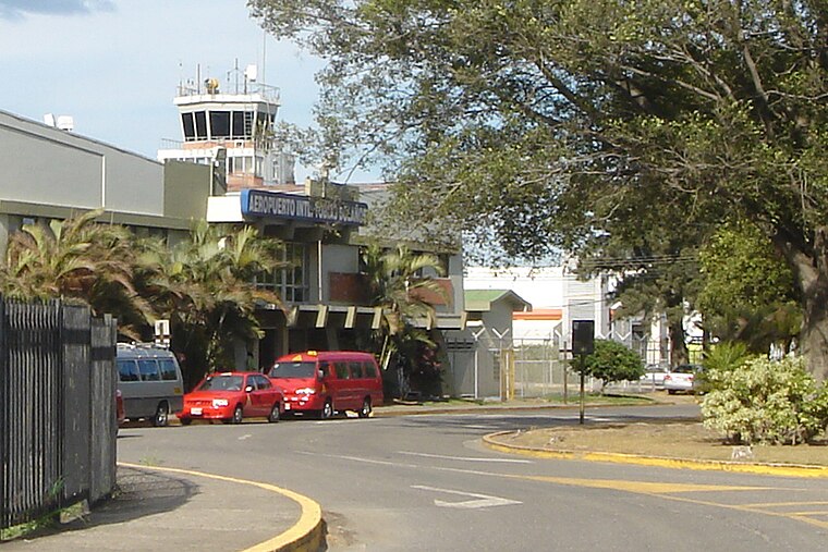
Photo: Mariordo, CC BY-SA 3.0.
Tobías Bolaños International Airport is one of four international airports in Costa Rica, and the secondary airport serving the city of San José, after Juan Santamaría International Airport. Tobías Bolaños International Airport is situated 3 km northwest of Escazú Music Academy.
La Sabana Metropolitan Park
Park
La Sabana Metropolitan Park is located in downtown San José, Costa Rica. It is the country's largest and most significant urban park. La Sabana is considered "the lungs of San José" by Costa Ricans. La Sabana Metropolitan Park is situated 2½ km east of Escazú Music Academy.
Places in the Area
Nearby places include Escazú and San Antonio District, Escazú.
Escazú
Town

Photo: Armando Maynez, CC BY 2.0.
Escazú is a district of the Escazú canton, in the San José province of Costa Rica.
San Antonio District, Escazú
Village
San Antonio is a district of the Escazú canton, in the San José province of Costa Rica. San Antonio District, Escazú is situated 3 km south of Escazú Music Academy.
Hatillo
Village
Hatillo is the tenth district of the San José canton, in the San José province of Costa Rica. Hatillo is situated 3 km southeast of Escazú Music Academy.
Escazú Music Academy
- Email: info@escazumusic.com
- Type: Music school
- Category: education
- Location: San José Province, Costa Rica, Central America, North America
- View on OpenStreetMap
Latitude
9.93139° or 9° 55′ 53″ northLongitude
-84.12664° or 84° 7′ 36″ westOpen location code
66XQWVJF+H8OpenStreetMap ID
node 12629889901OpenStreetMap feature
amenity=music_school
This page is based on OpenStreetMap, Wikidata, and Wikimedia Commons.
We’d love your help improving our open data sources. Thank you for contributing.
Satellite Map
Discover Escazú Music Academy from above in high-definition satellite imagery.
Notable Places Nearby
Highlights include Plaza Anonos and Centro Comercial Cocorí.
Nearby Places
Explore places such as Bubbly Tea and ChuBBs.
Costa Rica: Must-Visit Destinations
Delve into San José, Alajuela, Puerto Limón, and Liberia.
Curious Music Schools to Discover
Uncover intriguing music schools from every corner of the globe.
About Mapcarta. Data © OpenStreetMap contributors and available under the Open Database License". Text is available under the CC BY-SA 4.0 license, except for photos, directions, and the map. Photo: Andy Rusch, CC BY 2.0.