Tour de Montfallet
Tour de Montfallet is in Laval-en-Belledonne, Arrondissement of Grenoble, Auvergne-Rhône-Alpes. Tour de Montfallet is situated nearby to the cemetery Cimetière de Laval, as well as near the school École primaire Le Bourg.| Tap on a place to explore it |
Places of Interest Nearby
Highlights include Tour de Montfallet and Église Saint-Étienne de Laval-en-Belledonne.
Tour de Montfallet
Scenic viewpoint
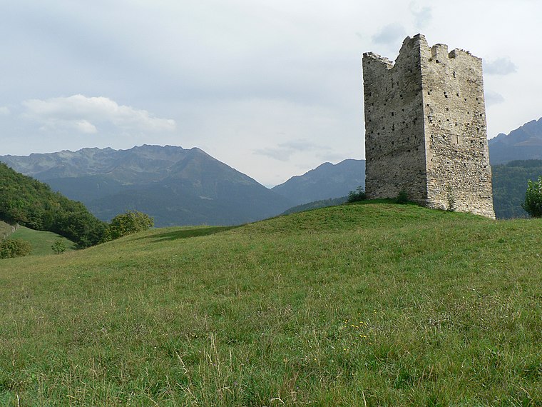
Photo: Jvillafruela, CC BY-SA 3.0.
Tour de Montfallet is a scenic viewpoint, which is situated 120 metres west of Tour de Montfallet.
Église Saint-Étienne de Laval-en-Belledonne
Church

Photo: Jvillafruela, CC BY-SA 3.0.
Église Saint-Étienne de Laval-en-Belledonne is a church, which is situated 580 metres southeast of Tour de Montfallet.
Église Sainte-Thérèse de Brignoud
Church

Photo: GAllegre, CC BY-SA 3.0.
Église Sainte-Thérèse de Brignoud is a church, which is situated 1½ km west of Tour de Montfallet.
Places in the Area
Nearby places include Sainte-Agnès and Saint-Mury-Monteymond.
Sainte-Agnès
Village

Photo: Patafisik, CC BY-SA 4.0.
Sainte-Agnès is a commune in the Isère department in southeastern France.
Saint-Mury-Monteymond
Village

Photo: Wmcnamara, CC BY-SA 3.0.
Saint-Mury-Monteymond is a commune in the Isère department in the region Auvergne-Rhône-Alpes of France. Saint-Mury-Monteymond is situated 3½ km south of Tour de Montfallet.
La Combe-de-Lancey
Village
 La Combe-de-Lancey is a commune in the Isère department in Auvergne-Rhône-Alpes region in southeastern France. The municipality covers an area of over 1,800 hectares. La Combe-de-Lancey is situated 4 km southwest of Tour de Montfallet.
Tour de Montfallet
- Type: Sign
- Categories: information and tourism
- Location: Laval-en-Belledonne, Arrondissement of Grenoble, Isère, Auvergne-Rhône-Alpes, France, Europe
- View on OpenStreetMap
Latitude
45.25631° or 45° 15′ 23″ northLongitude
5.92783° or 5° 55′ 40″ eastElevation
735 metres (2,411 feet)Open location code
8FQ77W4H+G4OpenStreetMap ID
node 12714276964OpenStreetMap feature
tourism=information
This page is based on OpenStreetMap, Wikidata, and Wikimedia Commons.
We’d love your help improving our open data sources. Thank you for contributing.
Satellite Map
Discover Tour de Montfallet from above in high-definition satellite imagery.
Places with the Same Name
Discover other places named “Tour de Montfallet”.
Notable Places Nearby
Highlights include Cimetière de Laval and École primaire Le Bourg.
Nearby Places
Explore places such as Derrière la Tour and Laval - Château.
Isère: Must-Visit Destinations
Delve into Grenoble, Vienne, Voiron, and Alpe d’Huez.
Curious Places to Discover
Uncover intriguing places from every corner of the globe.
About Mapcarta. Data © OpenStreetMap contributors and available under the Open Database License". Text is available under the CC BY-SA 4.0 license, except for photos, directions, and the map. Photo: Samat, CC BY-SA 3.0.