Chair of Geoinformatics
Chair of Geoinformatics is an office in Munich, Upper Bavaria, Bavaria which is located on Arcisstraße. Chair of Geoinformatics is situated nearby to Technical University Munich, as well as near University Library of the Technische Universität München.| Tap on a place to explore it |
Places of Interest Nearby
Highlights include Alte Pinakothek and University Library of the Technische Universität München.
Alte Pinakothek
Museum

Photo: Wikimedia, CC BY-SA 3.0.
The Alte Pinakothek is an art museum located in the Kunstareal area in Munich, Germany. It is one of the oldest galleries in the world and houses a significant collection of Old Master paintings. Alte Pinakothek is situated 180 metres southeast of Chair of Geoinformatics.

Pinakothek der Moderne
Museum
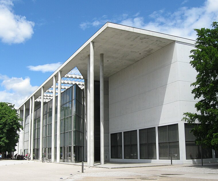
Photo: Rufus46, CC BY-SA 3.0.
The Pinakothek der Moderne is a modern art museum, situated in central Munich's Kunstareal. Pinakothek der Moderne is situated 390 metres southeast of Chair of Geoinformatics.
Places in the Area
Nearby places include Maxvorstadt and St.-Benno-Viertel.
Maxvorstadt

Photo: Tbp386, CC BY-SA 3.0.
Maxvorstadt is the arts and university district of Munich, just north of Altstadt the historic city centre.
Altstadt

Photo: Ypsilon from Finland, CC0.
Altstadt meaning "old city" is the very heart of Munich. Three gates are all that remain of the medieval defensive walls, but within is a well-preserved district with many of Munich's iconic sights: twin-towered Frauenkirche, New City Hall with clockwork figures dancing to the chimes of its Glockenspiel, and Hofbräuhaus that temple to drinking and gorging.
Chair of Geoinformatics
- Type: Research
- Address: Arcisstraße 21, München, 80333
- Categories: office and education
- Location: Munich, Upper Bavaria, Bavaria, Germany, Central Europe, Europe
- View on OpenStreetMap
Latitude
48.14939° or 48° 8′ 58″ northLongitude
11.5682° or 11° 34′ 6″ eastOpen location code
8FWH4HX9+Q7OpenStreetMap ID
node 12715530879OpenStreetMap feature
office=research
This page is based on OpenStreetMap, Wikidata, and Wikimedia Commons.
We’d love your help improving our open data sources. Thank you for contributing.
Satellite Map
Discover Chair of Geoinformatics from above in high-definition satellite imagery.
In Other Languages
“Chair of Geoinformatics” goes by many names.
- German: “Lehrstuhl für Geoinformatik”
Notable Places Nearby
Highlights include Technical University Munich and Theresianum.
Nearby Places
Explore places such as Professorship of Photogrammetry and Remote Sensing and Chair of Urban Structure and Transport Planning.
Munich: Must-Visit Destinations
Delve into North Munich, Altstadt, Haidhausen, and Ludwigsvorstadt-Isarvorstadt.
Curious Places to Discover
Uncover intriguing places from every corner of the globe.
About Mapcarta. Data © OpenStreetMap contributors and available under the Open Database License". Text is available under the CC BY-SA 4.0 license, except for photos, directions, and the map. Photo: Heav84, CC BY-SA 3.0.