Südkreuzgemeinde
Südkreuzgemeinde is a community center in Karlsruhe, Rhine-Neckar, Baden-Württemberg. Südkreuzgemeinde is situated nearby to the memorial Stolperstein dedicated to Emilie Behr, as well as near Stolperstein dedicated to Emil Behr.| Tap on a place to explore it |
Places of Interest Nearby
Highlights include Karlsruhe Zoo and Stolperstein dedicated to Emilie Behr.
Karlsruhe Zoo
Park
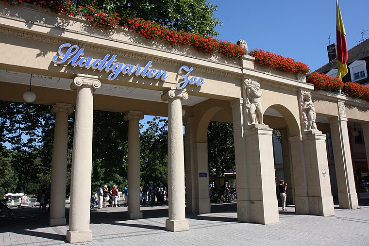
Photo: Root66, CC BY-SA 3.0.
The Karlsruhe Zoo is a city garden with a zoo in the southwest of Karlsruhe, Germany. It also encompasses the outer area; Tierpark Oberwald in the southeast of the city. Karlsruhe Zoo is situated 370 metres east of Südkreuzgemeinde.
Stolperstein dedicated to Emilie Behr
Memorial

Photo: Frank C. Müller, CC BY-SA 4.0.
Stolperstein dedicated to Emilie Behr is a memorial.
Stolperstein dedicated to Emil Behr
Memorial

Photo: Frank C. Müller, CC BY-SA 4.0.
Stolperstein dedicated to Emil Behr is a memorial.
Places in the Area
Nearby places include Mühlburg and Wolfartsweier.
Mühlburg
Suburb

Photo: Baden-Paul, CC0.
Mühlburg is a district of Karlsruhe, Germany. The district is further divided into Alt-Mühlburg, Weingärtensiedlung, Rheinhafen and Mühlburger Feld. Mühlburg is situated 3 km northwest of Südkreuzgemeinde.
Wolfartsweier
Suburb
Wolfartsweier is a village and a quarter of Karlsruhe, Baden-Württemberg, Germany. Its population is 3,068. It was first mentioned in 1261 AD under the name of "Wolvoldeswilere". Wolfartsweier is situated 5 km southeast of Südkreuzgemeinde.
Neureut
Suburb
Neureut is the northernmost district of Karlsruhe, Germany. It was the most populous rural community of Baden-Württemberg before being incorporated into Karlsruhe on February 14, 1975. Neureut is situated 5 km north of Südkreuzgemeinde.
Südkreuzgemeinde
- Type: Community center
- Location: Karlsruhe, Karlsruhe Region, Rhine-Neckar, Baden-Württemberg, Germany, Central Europe, Europe
- View on OpenStreetMap
Latitude
48.99962° or 48° 59′ 59″ northLongitude
8.39618° or 8° 23′ 46″ eastOpen location code
8FWCX9XW+RFOpenStreetMap ID
node 12723164823OpenStreetMap feature
amenity=community_centre
This page is based on OpenStreetMap, Wikidata, and Wikimedia Commons.
We’d love your help improving our open data sources. Thank you for contributing.
Satellite Map
Discover Südkreuzgemeinde from above in high-definition satellite imagery.
Notable Places Nearby
Highlights include Stolperstein dedicated to Erich Cohn and Stolperstein dedicated to Lina Cohn.
Nearby Places
Explore places such as Carl-Benz-Denkmal and Haus der Diakonie.
Rhine-Neckar: Must-Visit Destinations
Delve into Heidelberg, Mannheim, Heilbronn, and Sinsheim.
Curious Community Centers to Discover
Uncover intriguing community centers from every corner of the globe.
About Mapcarta. Data © OpenStreetMap contributors and available under the Open Database License". Text is available under the CC BY-SA 4.0 license, except for photos, directions, and the map. Photo: Ruhrfisch, CC BY-SA 3.0.