Torgelow Ascherslebener Weg
Torgelow Ascherslebener Weg is an electrical substation in Torgelow, Vorpommern-Greifswald, Mecklenburg-Western Pomerania. Torgelow Ascherslebener Weg is situated nearby to the industrial building Eisengießerei Torgelow, as well as near the railway station Torgelow station.| Tap on a place to explore it |
Places of Interest Nearby
Highlights include Torgelow station and Christuskirche (Torgelow).
Torgelow station
Railway station

Photo: Mathes1984, CC BY-SA 3.0.
Torgelow is a railway station in the town of Torgelow, Mecklenburg-Vorpommern, Germany. The station lies on the Jatznick–Ueckermünde railway line and the train services are operated by DB Regio Nordost. Torgelow station is situated 1 km east of Torgelow Ascherslebener Weg.
Christuskirche (Torgelow)
Church

Photo: Mathes1984, CC BY-SA 3.0.
Christuskirche (Torgelow) is a church, which is situated 1¼ km southeast of Torgelow Ascherslebener Weg.
Burg Torgelow
Castle
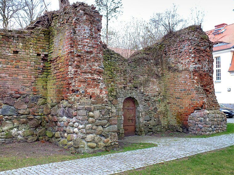
Photo: Mathes1984, CC BY-SA 3.0.
Burg Torgelow is a castle, which is situated 1½ km southeast of Torgelow Ascherslebener Weg.
Places in the Area
Nearby places include Torgelow and Hammer an der Uecker.
Torgelow
Town
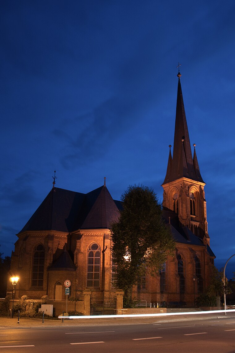
Photo: Mathes1984, CC BY-SA 3.0.
Torgelow is a municipality in the Vorpommern-Greifswald district, in Mecklenburg-Western Pomerania in north-eastern Germany. It is situated on the river Uecker, 12 km south of Ueckermünde, and 41 km northwest of Szczecin, Poland.
Hammer an der Uecker
Village

Photo: Global Fish, CC BY-SA 4.0.
Hammer an der Uecker is a municipality in the Vorpommern-Greifswald district, in Mecklenburg-Vorpommern, Germany. The eponymous Uecker is a proximate river. Hammer an der Uecker is situated 4 km south of Torgelow Ascherslebener Weg.
Stallberg
Hamlet

Photo: Wikimedia, CC BY-SA 3.0.
Stallberg is a hamlet, which is situated 7 km south of Torgelow Ascherslebener Weg.
Torgelow Ascherslebener Weg
- Type: Electrical substation
- Category: industry
- Location: Torgelow, Vorpommern-Greifswald, Mecklenburg-Western Pomerania, Germany, Central Europe, Europe
- View on OpenStreetMap
Latitude
53.6355° or 53° 38′ 8″ northLongitude
13.99384° or 13° 59′ 38″ eastOperator
E.DIS NetzOpen location code
9F5MJXPV+6GOpenStreetMap ID
node 12772718362
This page is based on OpenStreetMap, Wikidata, and Wikimedia Commons.
We’d love your help improving our open data sources. Thank you for contributing.
Satellite Map
Discover Torgelow Ascherslebener Weg from above in high-definition satellite imagery.
Notable Places Nearby
Highlights include Eisengießerei Torgelow and Filialkirche Herz Jesu.
Nearby Places
Explore places such as Industriegebiet Borkenstraße and Forstamt Torgelow.
Mecklenburg-Western Pomerania: Must-Visit Destinations
Delve into Schwerin, Rostock, Wismar, and Stralsund.
Curious Electrical Substations to Discover
Uncover intriguing electrical substations from every corner of the globe.
About Mapcarta. Data © OpenStreetMap contributors and available under the Open Database License". Text is available under the CC BY-SA 4.0 license, except for photos, directions, and the map. Photo: Schiwago, CC BY 2.5.