SuperBrugsen Søborg Hovedgade
SuperBrugsen Søborg Hovedgade is a supermarket in Gladsaxe Municipality, Capital Region. SuperBrugsen Søborg Hovedgade is situated nearby to Søborg School, as well as near Søborg Church.| Tap on a place to explore it |
Places of Interest Nearby
Highlights include Søborg Church and Munkegaard School.
Søborg Church
Church

Photo: Hemmingsen, CC BY-SA 3.0.
Søborg Church is situated 300 metres northwest of SuperBrugsen Søborg Hovedgade.
Munkegaard School
School

Photo: seier seier, CC BY 2.0.
Munkegaard School is a school in Gentofte, just north of Copenhagen, designed by the Danish architect Arne Jacobsen and completed in 1957. The complex is considered to be one of Jacobsen's most important architectural works. Munkegaard School is situated 420 metres northeast of SuperBrugsen Søborg Hovedgade.
Gladsaxe Stadium
Stadium
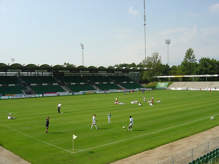
Photo: Froztbyte, CC BY-SA 3.0.
Gladsaxe Stadium is a sports center located on Gladsaxevej 200, Søborg, Gladsaxe Municipality, in Copenhagen, which is primarily used for association football matches. Gladsaxe Stadium is situated 1¼ km west of SuperBrugsen Søborg Hovedgade.
Places in the Area
Nearby places include Søborg and Vangede.
Søborg
Suburb

Photo: Pechke, Public domain.
Søborg is a neighbourhood in Gladsaxe Municipality, located some 10 km northwest of central Copenhagen, Denmark.
Vangede
Suburb

Photo: Henrik Johansen, CC BY-SA 2.0.
Vangede is a suburb 8 km north of central Copenhagen, Denmark. This area is primarily made up of one and two family houses and two and three story apartment buildings.
Emdrup
Quarter

Photo: Dannebrog Spy, CC BY-SA 3.0.
Emdrup is a neighbourhood straddling the border between the Bispebjerg and Østerbro district of Copenhagen, Denmark. It is located between Utterslev Mose in the west and the Helsingør Motorway in the east, just south of the border with Gladsaxe and Gentofte municipalities.
SuperBrugsen Søborg Hovedgade
- Opening hours: 7:00 AM—8:00 PM
- Type: Supermarket
- Categories: shop and food
- Location: Gladsaxe Municipality, Capital Region, Denmark, Nordic countries, Europe
- View on OpenStreetMap
Latitude
55.73372° or 55° 44′ 1″ northLongitude
12.51582° or 12° 30′ 57″ eastBranch
Søborg HovedgadeBrand
SuperBrugsenOpen location code
9F7JPGM8+F8OpenStreetMap ID
node 12798703122OpenStreetMap feature
shop=supermarket
This page is based on OpenStreetMap, Wikidata, and Wikimedia Commons.
We’d love your help improving our open data sources. Thank you for contributing.
Satellite Map
Discover SuperBrugsen Søborg Hovedgade from above in high-definition satellite imagery.
Notable Places Nearby
Highlights include Søborg School and PureGym.
Nearby Places
Explore places such as SuperBrugsen Søborg Hovedgade Slagter and Erik Bøghs Allé.
Denmark: Must-Visit Destinations
Delve into Copenhagen, Aarhus, Odense, and Aalborg.
Curious Supermarkets to Discover
Uncover intriguing supermarkets from every corner of the globe.
About Mapcarta. Data © OpenStreetMap contributors and available under the Open Database License". Text is available under the CC BY-SA 4.0 license, except for photos, directions, and the map. Photo: Wikimedia, CC BY-SA 3.0.