Beadnell Slopes
Beadnell Slopes is a parking area in Borough of Bell Acres, Allegheny County, Pennsylvania. Beadnell Slopes is situated nearby to the nature reserve NW Allegheny Conservation Area - ALT, as well as near the ruins Merriman House foundation.| Tap on a place to explore it |
Places in the Area
Nearby places include Byersdale and Baden.
Byersdale
Hamlet
Byersdale is an unincorporated community in Harmony Township, Pennsylvania, United States. The community is located in Beaver County along Pennsylvania Route 65, directly north of the confluence of the Ohio River and Legionville Run and directly south of Baden. Byersdale is situated 3½ miles northwest of Beadnell Slopes.
Baden
Village

Photo: Nyttend, Public domain.
Baden is a borough in southeastern Beaver County, Pennsylvania, along the Ohio River. The population was 3,904 at the 2020 census. It is part of the Pittsburgh metropolitan area. Baden is the former site of Logstown, a significant Native American settlement. Baden is situated 4 miles northwest of Beadnell Slopes.
Sewickley
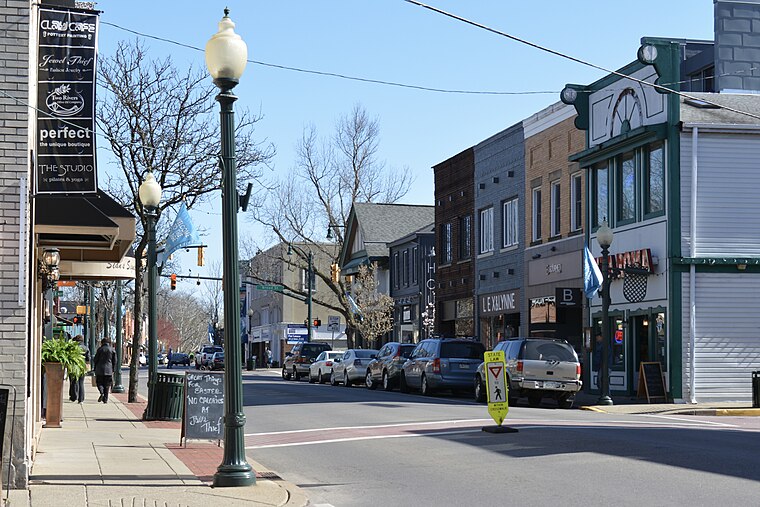
Photo: Rudytoots, CC BY-SA 4.0.
Sewickley, located 20 minutes by car outside of the city of Pittsburgh in western Pennsylvania, is a quaint resort town offering many boutique shops, services, and restaurants.
Beadnell Slopes
- Type: Parking area
- Parking: surface
- Category: transportation
- Location: Borough of Bell Acres, Allegheny County, Pittsburgh Region, Pennsylvania, Mid-Atlantic, United States, North America
- View on OpenStreetMap
Latitude
40.59816° or 40° 35′ 53″ northLongitude
-80.16988° or 80° 10′ 12″ westOpen location code
86GXHRXJ+72OpenStreetMap ID
node 12815604977OpenStreetMap feature
amenity=parkingOpenStreetMap attribute
parking=surface
This page is based on OpenStreetMap, Wikidata, and Wikimedia Commons.
We’d love your help improving our open data sources. Thank you for contributing.
Satellite Map
Discover Beadnell Slopes from above in high-definition satellite imagery.
Notable Places Nearby
Highlights include Beadnell Slopes Conservation Area and NW Allegheny Conservation Area - ALT.
Nearby Places
Explore places such as Dave’s Tavern and Bell Acres Nature Park.
Allegheny County: Must-Visit Destinations
Delve into Pittsburgh, Oakland, Downtown Pittsburgh, and South Side.
Curious Parking Areas to Discover
Uncover intriguing parking areas from every corner of the globe.
About Mapcarta. Data © OpenStreetMap contributors and available under the Open Database License". Text is available under the CC BY-SA 4.0 license, except for photos, directions, and the map. Photo: Albright.kevin.s, CC BY-SA 3.0.