Anomaly Powerbuilding
Anomaly Powerbuilding is a health club in Fairfield, Butler County, Ohio which is located on Gilmore Road. Anomaly Powerbuilding is situated nearby to North Fairfield Baptist Church, as well as near the police station Fairfield Township Police Department.| Tap on a place to explore it |
- Opening hours: 24/7
- Type: Health club
- Address: B, 6749 Gilmore Road, hamilton, oh 45011
Places of Interest Nearby
Highlights include Butler County Regional Airport and Greenwood Cemetery.
Butler County Regional Airport
Aerodrome

Photo: redlegsfan21, CC BY-SA 2.0.
Butler County Regional Airport is a publicly owned, public use airport at 2820 Airport Road East in Hamilton, Ohio, United States. It is owned by the Butler County Board of Commissioners. Butler County Regional Airport is situated 1½ miles south of Anomaly Powerbuilding.
Greenwood Cemetery
Cemetery
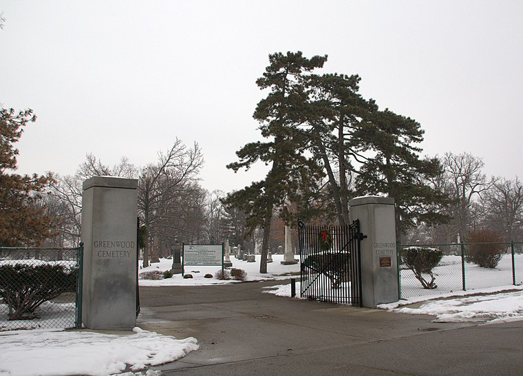
Photo: Greg5030, CC BY-SA 3.0.
Greenwood Cemetery is a registered historic district in Hamilton, Ohio, listed in the National Register of Historic Places on July 22, 1994. It contains 5 contributing buildings. Greenwood Cemetery is situated 2 miles northwest of Anomaly Powerbuilding.
Beth Israel Synagogue
Synagogue
Beth Israel Synagogue is a Conservative synagogue located at 50 North 6th Street in Hamilton, Ohio, in the United States. It was founded in 1901 as an Orthodox alternative to Hamilton's existing Reform synagogue, and completed its current building in 1931. Beth Israel Synagogue is situated 2 miles west of Anomaly Powerbuilding.
Places in the Area
Nearby places include Dayton–Campbell Historic District and German Village Historic District.
Dayton–Campbell Historic District
Neighborhood

Photo: Greg5030, CC BY-SA 3.0.
Dayton Lane Historic District is a registered historic district in Hamilton, Ohio, listed in the National Register on 1983-06-30. It contains 209 contributing buildings. Dayton–Campbell Historic District is situated 2 miles northwest of Anomaly Powerbuilding.
German Village Historic District
Neighborhood

Photo: Greg5030, CC BY-SA 3.0.
German Village Historic District is a registered historic district in Hamilton, Ohio, listed in the National Register of Historic Places on February 7, 1991. German Village Historic District is situated 2½ miles northwest of Anomaly Powerbuilding.
Hamilton

Photo: S&Mj Adventures, CC BY-SA 2.0.
Hamilton is a city in Butler County, Ohio, United States, and its county seat. It is 20 miles north of Cincinnati along the Great Miami River. The population was 63,399 at the 2020 census, making Hamilton the second-most populous city in the Cincinnati metropolitan area and the tenth-most populous city in Ohio.
Anomaly Powerbuilding
- Categories: recreation area and sports location
- Location: Fairfield, Butler County, Greater Cincinnati, Ohio, Midwest, United States, North America
- View on OpenStreetMap
Latitude
39.38717° or 39° 23′ 14″ northLongitude
-84.51669° or 84° 31′ 0″ westOpen location code
86FQ9FPM+V8OpenStreetMap ID
node 12818233988OpenStreetMap feature
leisure=fitness_centreOpenStreetMap feature
sport=fitnessOpenStreetMap feature
sport=gym
This page is based on OpenStreetMap, Wikidata, and Wikimedia Commons.
We’d love your help improving our open data sources. Thank you for contributing.
Satellite Map
Discover Anomaly Powerbuilding from above in high-definition satellite imagery.
Notable Places Nearby
Highlights include North Fairfield Baptist Church and Holly’s Dog Park.
Nearby Places
Explore places such as Dollar Tree and Tom Gill Buick GMC.
Butler County: Must-Visit Destinations
Delve into Hamilton, Oxford, Monroe, and West Chester.
Curious Health Clubs to Discover
Uncover intriguing health clubs from every corner of the globe.
About Mapcarta. Data © OpenStreetMap contributors and available under the Open Database License". Text is available under the CC BY-SA 4.0 license, except for photos, directions, and the map. Photo: Andrew C, CC BY 2.0.