Eagle Ridge
Eagle Ridge is a neighborhood in Montgomery County, Capital Region, Maryland. Eagle Ridge is situated nearby to the locality Carderock, as well as near the neighborhood Mazza Falls.| Tap on a place to explore it |
Places of Interest
Highlights include Lock 14 and Carderock Recreation Area.

Carderock Recreation Area
Picnic site
Carderock Recreation Area is a 100-acre park in Carderock, Maryland, part of the Chesapeake and Ohio Canal National Historical Park. The area is well known as a destination for its outdoor activities of rock climbing, hiking and biking.
David Taylor Model Basin
Industrial building

Photo: Wikimedia, Public domain.
The David W. Taylor Model Basin is one of the largest ship model basins—test facilities for the development of ship design—in the world. DTMB is a field activity of the Carderock Division of the Naval Surface Warfare Center.
Places in the Area
Nearby places include Carderock and Carderock Springs Historic District.
Carderock
Locality
Carderock is an unincorporated community in Montgomery County, Maryland, United States, along the Potomac River. It is located in the southern part of the Potomac census-designated place and western part of the Bethesda postal area.
Carderock Springs Historic District
Neighborhood

Photo: Farragutful, CC BY-SA 3.0.
Carderock Springs Historic District is a national historic district located at Bethesda, Montgomery County, Maryland. The district encompasses 275 modernist houses located northwest of Bethesda. Carderock Springs Historic District is situated 1½ miles east of Eagle Ridge.
Cabin John
Village
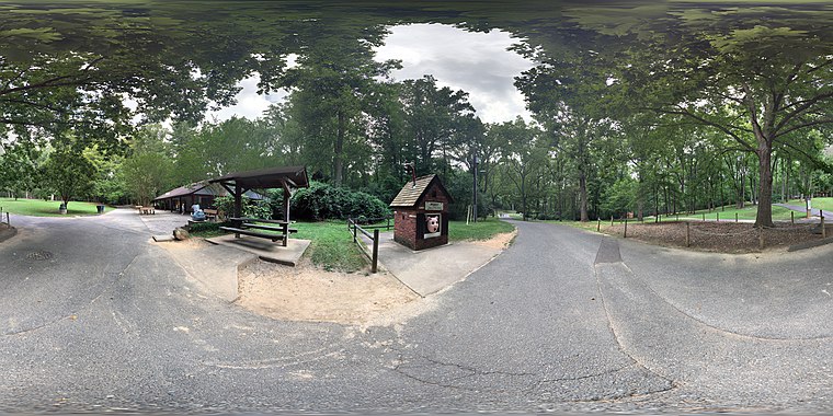
Photo: Fuzheado, CC BY-SA 4.0.
Cabin John is a census-designated place and unincorporated area in Montgomery County, Maryland, United States. As of the 2020 census, it had a population of 2,459. Overlooking the Potomac River, it is a suburb of Washington, D.C.… Cabin John is situated 2 miles east of Eagle Ridge.
Eagle Ridge
- Type: Neighborhood
- Category: locality
- Location: Montgomery County, Capital Region, Maryland, Mid-Atlantic, United States, North America
- View on OpenStreetMap
Latitude
38.98358° or 38° 59′ 1″ northLongitude
-77.19769° or 77° 11′ 52″ westOpen location code
87C4XRM2+CWOpenStreetMap ID
node 12834626584OpenStreetMap feature
place=neighbourhood
This page is based on OpenStreetMap, Wikidata, and Wikimedia Commons.
We’d love your help improving our open data sources. Thank you for contributing.
Satellite Map
Discover Eagle Ridge from above in high-definition satellite imagery.
Places with the Same Name
Discover other places named “Eagle Ridge”.
Localities in the Area
Explore places such as Mazza Falls and River Falls.
Notable Places Nearby
Highlights include Rock Run Stream Valley Park and Naval Surface Warfare Center Fire Station 52.
Montgomery County: Must-Visit Destinations
Delve into Rockville, Bethesda, Gaithersburg, and Takoma Park.
Curious Neighborhoods to Discover
Uncover intriguing neighborhoods from every corner of the globe.
About Mapcarta. Data © OpenStreetMap contributors and available under the Open Database License". Text is available under the CC BY-SA 4.0 license, except for photos, directions, and the map. Photo: Wikimedia, CC0.