Hotel & Resorts Fanø Bad
Hotel & Resorts Fanø Bad is a hotel in Fanø, Region of Southern Denmark. Hotel & Resorts Fanø Bad is situated nearby to the playground Lille skovlegeplads, as well as near Nordby Church.| Tap on a place to explore it |
Places of Interest Nearby
Highlights include Nordby Church.
Nordby Church
Church
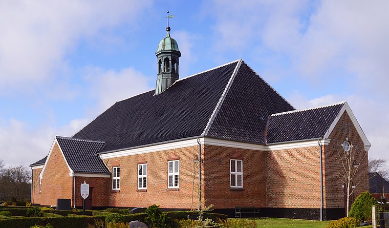
Photo: Wolfgang Pehlemann, CC BY-SA 3.0 de.
Nordby Church is situated 350 metres northeast of Hotel & Resorts Fanø Bad.
Places in the Area
Nearby places include Nordby and Esbjerg.
Nordby
Village

Photo: Hubertus45, CC BY 2.5.
Nordby is a Danish town, seat of the Fanø Municipality, in the Region of Southern Denmark. The population was 2,629 as of 1 January 2025.
Esbjerg

Photo: Taxiarchos228, FAL.
Esbjerg is a city in Southwestern Jutland. The town was once Denmark's biggest fishing harbour, and the harbour is still an economic driving force in the town.
Jerne
Suburb

Photo: Flickr, CC BY-SA 2.0.
Jerne is a suburb, which is situated 7 km northeast of Hotel & Resorts Fanø Bad.
Hotel & Resorts Fanø Bad
- Type: Hotel
- Categories: tourism, accommodation, and building
- Location: Fanø, Region of Southern Denmark, Denmark, Nordic countries, Europe
- View on OpenStreetMap
Latitude
55.43817° or 55° 26′ 17″ northLongitude
8.39367° or 8° 23′ 37″ eastOpen location code
9F7CC9QV+7FOpenStreetMap ID
node 12847893460OpenStreetMap feature
tourism=hotel
This page is based on OpenStreetMap, Wikidata, and Wikimedia Commons.
We’d love your help improving our open data sources. Thank you for contributing.
Satellite Map
Discover Hotel & Resorts Fanø Bad from above in high-definition satellite imagery.
Notable Places Nearby
Highlights include Lille skovlegeplads and Nordre Kirkegård.
Nearby Places
Explore places such as OK and Bygma Fanø - Byggecenter.
Denmark: Must-Visit Destinations
Delve into Copenhagen, Aarhus, Odense, and Aalborg.
Curious Hotels to Discover
Uncover intriguing hotels from every corner of the globe.
About Mapcarta. Data © OpenStreetMap contributors and available under the Open Database License". Text is available under the CC BY-SA 4.0 license, except for photos, directions, and the map. Photo: Ragnar1904, CC BY-SA 4.0.