Wohnheim Salzburger Weg
Wohnheim Salzburger Weg is a social service facility in Rosenheim, Upper Bavaria, Bavaria which is located on Salzburger Weg. Wohnheim Salzburger Weg is situated nearby to the mosque Al Madina Moschee, as well as near Königlich privilegierte Feuerschützengesellschaft Rosenheim von 1486.| Tap on a place to explore it |
Places of Interest Nearby
Highlights include Christkönig and Rosenheim Railway Station.
Christkönig
Church

Photo: Rufus46, CC BY-SA 3.0.
Christkönig is a church, which is situated 610 metres southeast of Wohnheim Salzburger Weg.
Rosenheim Railway Station
Railway station
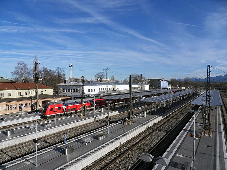
Photo: John-vogel, CC BY-SA 3.0.
Rosenheim station is the main railway station in the city of Rosenheim in Bavaria, Germany. It is the seventh largest passenger station in Bavaria and an important railway hub between the Munich–Rosenheim railway line and the lines to Salzburg, Kufstein/Innsbruck and Mühldorf, as well as the Mangfall Valley Railway. Rosenheim Railway Station is situated 1¼ km southeast of Wohnheim Salzburger Weg.
Hohenzollern-Park
Park

Photo: Rufus46, CC BY-SA 4.0.
Hohenzollern-Park is situated 1 km northeast of Wohnheim Salzburger Weg.
Places in the Area
Nearby places include Aising and Kolbermoor.
Aising
Suburb

Photo: Rufus46, CC BY-SA 3.0.
Aising is a suburb, which is situated 3 km south of Wohnheim Salzburger Weg.
Kolbermoor
Town

Photo: Rufus46, CC BY-SA 3.0.
Kolbermoor is a town in the district of Rosenheim, in Bavaria, Germany. It is situated 5 km west of Rosenheim on the river Mangfall. In 1859 Kolbermoor railway stop was built for the new Bavarian Maximilian's Railway. Kolbermoor is situated 3½ km west of Wohnheim Salzburger Weg.
Pang
Village

Photo: Rufus46, CC BY-SA 3.0.
Pang is a village, which is situated 4 km south of Wohnheim Salzburger Weg.
Wohnheim Salzburger Weg
- Type: Social service facility
- Address: Salzburger Weg 10, Rosenheim, 83024
- Location: Rosenheim, Upper Bavaria, Bavaria, Germany, Central Europe, Europe
- View on OpenStreetMap
Latitude
47.85925° or 47° 51′ 33″ northLongitude
12.10749° or 12° 6′ 27″ eastOperator
KJSWOpen location code
8FVJV454+PXOpenStreetMap ID
node 12875573297OpenStreetMap feature
amenity=social_facility
This page is based on OpenStreetMap, Wikidata, and Wikimedia Commons.
We’d love your help improving our open data sources. Thank you for contributing.
Satellite Map
Discover Wohnheim Salzburger Weg from above in high-definition satellite imagery.
Notable Places Nearby
Highlights include Al Madina Moschee and Königlich privilegierte Feuerschützengesellschaft Rosenheim von 1486.
Nearby Places
Explore places such as Lehrinstitut Rosenheim e.V. and Altenheim Elisabeth.
Upper Bavaria: Must-Visit Destinations
Delve into Munich, Ingolstadt, Dachau, and Garmisch-Partenkirchen.
Curious Social Service Facilities to Discover
Uncover intriguing social service facilities from every corner of the globe.
About Mapcarta. Data © OpenStreetMap contributors and available under the Open Database License". Text is available under the CC BY-SA 4.0 license, except for photos, directions, and the map. Photo: Helmlechner, CC BY-SA 4.0.