Killer Kebab
Killer Kebab is a fast food restaurant in Indre By, Copenhagen municipality, Capital Region. Killer Kebab is situated nearby to Christianshavns Torv, as well as near the metro station Christianshavn station.| Tap on a place to explore it |
Places of Interest Nearby
Highlights include Christianshavns Torv and Church of Our Saviour.
Christianshavns Torv
Square
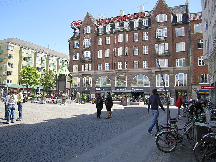
Photo: La Citta Vita, CC BY-SA 2.0.
Christianshavns Torv is the central public square of the Christianshavn neighborhood in Copenhagen, Denmark. It is situated at the intersection of Torvegade and Christianshavn Canal, roughly at the center of the area.
Church of Our Saviour
Church

Photo: Avda, CC BY-SA 3.0.
The Church of Our Saviour is a baroque church in Copenhagen, Denmark, most famous for the external spiral winding staircase that can be climbed to the top, offering extensive views over central Copenhagen. Church of Our Saviour is situated 220 metres northeast of Killer Kebab.
Christianshavn station
Metro station

Photo: Wikimedia, Public domain.
Christianshavn station is a rapid transit station on the Copenhagen Metro, served by the M1 and M2 lines. The station is located centrally in the Christianshavn district.
Places in the Area
Nearby places include Christianshavn and Amagerbro.
Christianshavn

Photo: Elgaard, CC BY-SA 3.0.
Christianshavn is a district east of the inner city of Copenhagen. Once a working-class neighbourhood, today Christianshavn is a trendy part of the city with its own unique identity. people from all walks of life, live side-by-side among cool cafes, old school bodegas, fancy restaurants and charming 19th-century houses along picturesque canals.
Amagerbro
Suburb
Amagerbro is an area in the northern part of the island Amager and a district in Copenhagen. The area is known as a working class area, and has approximately 20,000 inhabitants.
Christiania
 Christiania is a self-governing "free town" established in 1971, a city within the city, on the site of a military barracks as an alternative to mainstream culture. Christiania is considered to be the fourth largest tourist attraction in Copenhagen.
Killer Kebab
- Type: Fast food restaurant
- Cuisine: kebab
- Categories: food and restaurant
- Location: Indre By, Copenhagen municipality, Capital Region, Denmark, Nordic countries, Europe
- View on OpenStreetMap
Latitude
55.67164° or 55° 40′ 18″ northLongitude
12.59158° or 12° 35′ 30″ eastOpen location code
9F7JMHCR+MJOpenStreetMap ID
node 12886743182OpenStreetMap feature
amenity=fast_foodOpenStreetMap attribute
cuisine=kebab
This page is based on OpenStreetMap, Wikidata, and Wikimedia Commons.
We’d love your help improving our open data sources. Thank you for contributing.
Satellite Map
Discover Killer Kebab from above in high-definition satellite imagery.
Places with the Same Name
Discover other places named “Killer Kebab”.
Notable Places Nearby
Highlights include Christianshavns Torv and Christianshavns Beboerhus.
Nearby Places
Explore places such as City Wok and Pizzeria Kanalen.
Denmark: Must-Visit Destinations
Delve into Copenhagen, Aarhus, Odense, and Aalborg.
Curious Fast Food Restaurants to Discover
Uncover intriguing fast food restaurants from every corner of the globe.
About Mapcarta. Data © OpenStreetMap contributors and available under the Open Database License". Text is available under the CC BY-SA 4.0 license, except for photos, directions, and the map. Photo: Wikimedia, CC BY-SA 3.0.