Abzweig Leipzigs Rasen
Abzweig Leipzigs Rasen is in Oberstadt, Hildburghausen, Thuringia. Abzweig Leipzigs Rasen is situated nearby to the peak Steinbühl, as well as near the archaeological site Wüstung Leipzigs Rasen.| Tap on a place to explore it |
Places of Interest Nearby
Highlights include Rathaus Heinrichs and Protestant Church Mäbendorf.
Rathaus Heinrichs
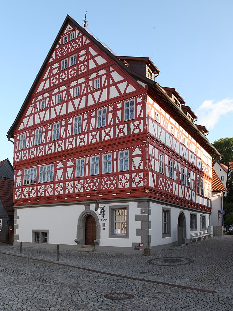
Photo: Störfix, CC BY-SA 3.0 de.
Rathaus Heinrichs is situated 3 km northeast of Abzweig Leipzigs Rasen.
Protestant Church Mäbendorf
Church

Photo: Störfix, CC BY-SA 3.0 de.
Protestant Church Mäbendorf is situated 2½ km north of Abzweig Leipzigs Rasen.
St. Ulrich
Church

Photo: Störfix, CC BY-SA 3.0 de.
St. Ulrich is a church, which is situated 3 km northeast of Abzweig Leipzigs Rasen.
Places in the Area
Nearby places include Mäbendorf and Heinrichs.
Heinrichs
Suburb
Photo: Störfix, CC BY-SA 3.0 de.
Heinrichs is a suburb, which is situated 3 km northeast of Abzweig Leipzigs Rasen.
Dietzhausen
Village

Photo: Störfix, CC BY-SA 3.0 de.
Dietzhausen is a village, which is situated 3 km northwest of Abzweig Leipzigs Rasen.
Abzweig Leipzigs Rasen
- Type: Sign
- Categories: information and tourism
- Location: Oberstadt, Hildburghausen, Thuringia, Germany, Central Europe, Europe
- View on OpenStreetMap
Latitude
50.58435° or 50° 35′ 4″ northLongitude
10.62316° or 10° 37′ 23″ eastElevation
600 metres (1,969 feet)Open location code
9F2GHJMF+P7OpenStreetMap ID
node 12897693805OpenStreetMap feature
tourism=information
This page is based on OpenStreetMap, Wikidata, and Wikimedia Commons.
We’d love your help improving our open data sources. Thank you for contributing.
Satellite Map
Discover Abzweig Leipzigs Rasen from above in high-definition satellite imagery.
Notable Places Nearby
Highlights include Steinbühl and Wüstung Leipzigs Rasen.
Nearby Places
Explore places such as Auberghütte and Wüstung ‘Leipzigs Rasen’.
Curious Places to Discover
Uncover intriguing places from every corner of the globe.
About Mapcarta. Data © OpenStreetMap contributors and available under the Open Database License". Text is available under the CC BY-SA 4.0 license, except for photos, directions, and the map. Photo: Taxiarchos228, FAL.