The Hoppening Place
The Hoppening Place is an event venue in Osceola, Florida. The Hoppening Place is situated nearby to the town hall Towne Hall, as well as near the tourism office Volunteer Services.| Tap on a place to explore it |
Places of Interest Nearby
Highlights include Kissimmee Gateway Airport.
Kissimmee Gateway Airport
Aerodrome
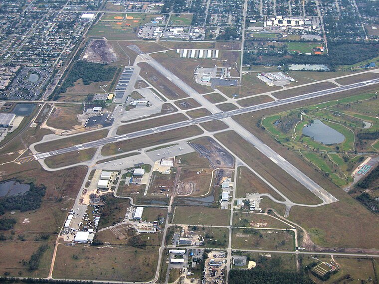
Photo: Darwininan, CC BY-SA 3.0.
Kissimmee Gateway Airport, formerly known as Kissimmee Municipal Airport, is a public airport in Kissimmee, a city in Osceola County, Florida, United States.
Places in the Area
Nearby places include Campbell and Kissimmee.
Campbell
Village
Campbell is a census-designated place and an unincorporated community in Osceola County, Florida, United States. Campbell City was named after Alfred Sidney Campbell who opened and operated the general store in the settlement. Campbell is situated 2 miles south of The Hoppening Place.
Kissimmee

Photo: Fredlyfish4, CC BY-SA 4.0.
Kissimmee is a city in Osceola County. Kissimmee is a popular Central Florida tourist destination because of its sunny weather, spring training baseball for major league clubs, and close proximity to Disney World.
Celebration

Photo: Bobak, CC BY-SA 2.5.
Celebration is a community in Osceola County, Florida, near Walt Disney World, designed by the Walt Disney Company to be a "perfect community". Though it was founded in 1994, the town feels a bit like something out of a TV show from the mid–20th century, with well-kept suburban houses and retro futurist architecture.
The Hoppening Place
- Type: Event venue
- Location: Osceola, Florida, United States, North America
- View on OpenStreetMap
Latitude
28.28834° or 28° 17′ 18″ northLongitude
-81.45771° or 81° 27′ 28″ westOpen location code
76WW7GQR+8WOpenStreetMap ID
node 12922042570OpenStreetMap feature
amenity=events_venue
This page is based on OpenStreetMap, Wikidata, and Wikimedia Commons.
We’d love your help improving our open data sources. Thank you for contributing.
Satellite Map
Discover The Hoppening Place from above in high-definition satellite imagery.
Notable Places Nearby
Highlights include Towne Hall and Volunteer Services.
Nearby Places
Explore places such as Cafe Clayton and Gingerbread House Resturant.
Florida: Must-Visit Destinations
Delve into Miami, Orlando, Walt Disney World, and Tallahassee.
Curious Event Venues to Discover
Uncover intriguing event venues from every corner of the globe.
About Mapcarta. Data © OpenStreetMap contributors and available under the Open Database License". Text is available under the CC BY-SA 4.0 license, except for photos, directions, and the map. Photo: Chad Sparkes, CC BY 2.0.