Jogglisdamm
Jogglisdamm is a locality in Vaduz, Liechtenstein. Jogglisdamm is situated nearby to the locality Eichlewasser, as well as near Auhof.| Tap on a place to explore it |
Places of Interest
Highlights include Liechtenstein State Library and Rheinpark Stadion.
Liechtenstein State Library
Library
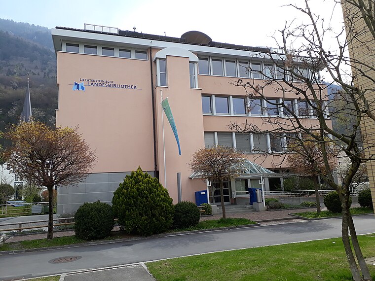 The Liechtenstein State Library is the legal deposit and copyright library for Liechtenstein. It was established by law in 1961 by the National Library Foundation.
Rheinpark Stadion
Pitch

Photo: Wikimedia, CC BY-SA 3.0.
Rheinpark Stadion in Vaduz is the national stadium of Liechtenstein. It plays host to home matches of the Liechtenstein national football team, and is also the home of football club FC Vaduz.
Vaduz Cathedral
Church
 Vaduz Cathedral, or Cathedral of St. Florin, is a neo-Gothic church in Vaduz, Liechtenstein, and the centre of the Archdiocese of Vaduz. Originally a parish church, was elevated to the status of cathedral in 1997, and has held that designation since.
Places in the Area
Nearby places include Sevelen and Rotenboden.
Sevelen
Village

Photo: Kabelleger, CC BY-SA 3.0.
Sevelen is a municipality in the Wahlkreis of Werdenberg in the canton of St. Gallen in Switzerland.
Rotenboden
Village
Rotenboden is a Weiler of Liechtenstein, located in the municipality of Triesenberg. It is the highest settlement in Liechtenstein at 850m elevation.
Triesen
Village

Photo: KPFC, CC BY-SA 4.0.
Triesen is the third largest municipality in Liechtenstein. It contains several historic churches dating from the fifteenth century. It also has a weaving mill from 1863 that is considered a historical monument. The population is around 5,275.
Jogglisdamm
- Type: Locality
- Location: Vaduz, Liechtenstein, Central Europe, Europe
- View on OpenStreetMap
Latitude
47.12336° or 47° 7′ 24″ northLongitude
9.51053° or 9° 30′ 38″ eastOpen location code
8FVF4GF6+86OpenStreetMap ID
node 12950244492OpenStreetMap feature
place=locality
This page is based on OpenStreetMap, Wikidata, and Wikimedia Commons.
We’d love your help improving our open data sources. Thank you for contributing.
Satellite Map
Discover Jogglisdamm from above in high-definition satellite imagery.
Localities in the Area
Explore places such as Eichlewasser and Auhof.
Notable Places Nearby
Highlights include Landespolizei and Grenzschild Liechtenstein-Schweiz.
Curious Localities to Discover
Uncover intriguing localities from every corner of the globe.
About Mapcarta. Data © OpenStreetMap contributors and available under the Open Database License". Text is available under the CC BY-SA 4.0 license, except for photos, directions, and the map. Photo: Wikimedia, CC BY-SA 2.5.