Padel Port Batumi
Padel Port Batumi is a sports venue in Adjara, Georgia. Padel Port Batumi is situated nearby to Batumi Lighthouse, as well as near Alphabetic Tower.| Tap on a place to explore it |
Places of Interest Nearby
Highlights include Alphabetic Tower and Batumi Lighthouse.
Alphabetic Tower

Photo: 23artashes, CC BY-SA 4.0.
The Alphabetic Tower is a 130-meter-high structure in Batumi, Georgia. The tower symbolizes the uniqueness of the Georgian alphabet and people. The structure combines the design of DNA, in its familiar double helix pattern. Alphabetic Tower is situated 150 metres northwest of Padel Port Batumi.

Nino & Ali Statue
Work of art

Photo: Robot8A, CC BY-SA 4.0.
Nino & Ali Statue is a work of art, which is situated 180 metres east of Padel Port Batumi.
Places in the Area
Nearby places include Batumi and Khelvachauri.
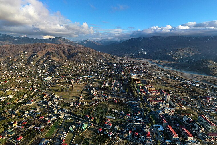
Batumi

Photo: Greg McMullen, CC BY-SA 2.0.
Batumi is the capital city of the Autonomous Republic of Ajara in the country of Georgia. Batumi's coastal location and sub-tropical climate make it a popular holiday destination.
Khelvachauri
Village
 Khelvachauri is a neighborhood of Batumi in the Autonomous Republic of Adjara in the southwest of Georgia, 8 kilometres southeast of the regional capital Batumi and situated on the right bank of the Chorokhi River. Khelvachauri is situated 8 km south of Padel Port Batumi.
Khelvach’auri
Village
Khelvach’auri is a village, which is situated 8 km south of Padel Port Batumi.
Padel Port Batumi
- Type: Sports venue
- Address: ბათუმი
- Categories: recreation area and sports location
- Location: Adjara, Georgia, Caucasus, Asia
- View on OpenStreetMap
Latitude
41.65528° or 41° 39′ 19″ northLongitude
41.64097° or 41° 38′ 28″ eastOperator
Padel clubOpen location code
8HH3MJ4R+49OpenStreetMap ID
node 12951654429OpenStreetMap feature
leisure=sports_centreOpenStreetMap feature
sport=padel
This page is based on OpenStreetMap, Wikidata, and Wikimedia Commons.
We’d love your help improving our open data sources. Thank you for contributing.
Satellite Map
Discover Padel Port Batumi from above in high-definition satellite imagery.
Notable Places Nearby
Highlights include Padel Port Batumi and Padel Port Batumi.
Nearby Places
Explore places such as Gate and Kibe.
Georgia: Must-Visit Destinations
Delve into South Ossetia, Tbilisi, Sukhumi, and Batumi.
Curious Sports Venues to Discover
Uncover intriguing sports venues from every corner of the globe.
About Mapcarta. Data © OpenStreetMap contributors and available under the Open Database License". Text is available under the CC BY-SA 4.0 license, except for photos, directions, and the map. Photo: MIKHEIL, CC BY-SA 4.0.