Folehavegård
Folehavegård is a farm in Guldborgsund Municipality, Region Zealand. Folehavegård is situated nearby to the community center Tårs Forsamlingshus, as well as near the archaeological site Barnehøj.| Tap on a place to explore it |
Places of Interest Nearby
Highlights include Tårs Church and Berritzgaard.
Tårs Church
Church
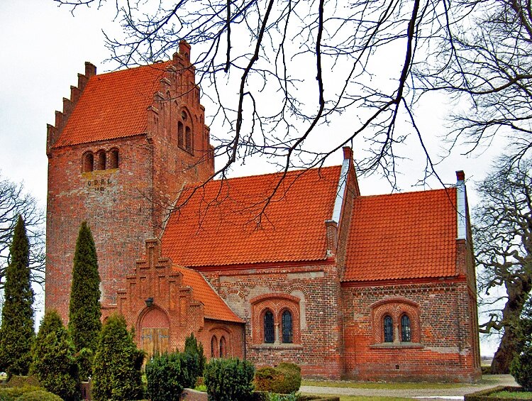
Photo: Bococo, CC BY-SA 3.0.
Tårs Church is situated 1¼ km southwest of Folehavegård.
Berritzgaard
Manor estate

Photo: Wikimedia, Public domain.
The Berritzgaard estate and manor house is one of the largest and best preserved manor houses on the island of Lolland in Denmark. The estate can be traced back to 1382, to its first owner, Markvard Pøiske. Berritzgaard is situated 2 km south of Folehavegård.
Orebygaard
Manor estate
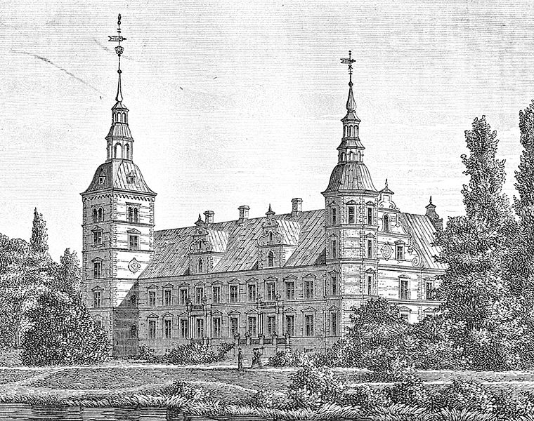
Photo: Wikimedia, Public domain.
Orebygaard is a manor house and estate located on Lolland in southeastern Denmark. The current main building, a Neo-Renaissance style building with two towers, is from 1872 to 1874. Orebygaard is situated 4 km west of Folehavegård.
Places in the Area
Nearby places include Sakskøbing and Guldborg.
Sakskøbing

Photo: Hubertus45, CC BY-SA 3.0.
Sakskøbing is a small town on Lolland. Sakskøbing is a town of approximately 5,000 inhabitants. Being a town with no big industries or services it offers a glimpse of very authentic Danish rural life.
Guldborg
Village

Photo: Lcl, CC BY-SA 3.0.
Guldborg is a fishing village spanning the islands of Falster and Lolland in Denmark. It belongs to Guldborgsund Municipality, in Region Zealand. In 2025 the village had a population of 495, with about 400 living on the Lolland side. Guldborg is situated 7 km northeast of Folehavegård.
Våbensted
Hamlet

Photo: Hubertus, CC BY-SA 3.0.
Våbensted is a hamlet, which is situated 7 km southwest of Folehavegård.
Folehavegård
- Type: Farm
- Categories: locality and agriculture
- Location: Guldborgsund Municipality, Region Zealand, Denmark, Nordic countries, Europe
- View on OpenStreetMap
Latitude
54.84029° or 54° 50′ 25″ northLongitude
11.65296° or 11° 39′ 11″ eastOpen location code
9F6HRMR3+45OpenStreetMap ID
node 12985446888OpenStreetMap feature
place=farm
This page is based on OpenStreetMap, Wikidata, and Wikimedia Commons.
We’d love your help improving our open data sources. Thank you for contributing.
Satellite Map
Discover Folehavegård from above in high-definition satellite imagery.
Places with the Same Name
Discover other places named “Folehavegård”.
Notable Places Nearby
Highlights include Tårs Forsamlingshus and Barnehøj.
Nearby Places
Explore places such as Arildsminde and Barnehøjgård.
Denmark: Must-Visit Destinations
Delve into Copenhagen, Aarhus, Odense, and Aalborg.
Curious Farms to Discover
Uncover intriguing farms from every corner of the globe.
About Mapcarta. Data © OpenStreetMap contributors and available under the Open Database License". Text is available under the CC BY-SA 4.0 license, except for photos, directions, and the map. Photo: Inkey, CC BY 2.0.