Reye’s Deli Mexicana Inc.
Reye’s Deli Mexicana Inc. is a convenience store in Staten Island, New York. Reye’s Deli Mexicana Inc. is situated nearby to the fire station New York Engine Company 157, as well as near New York Ladder Company 80.| Tap on a place to explore it |
Places of Interest Nearby
Highlights include Temple Emanu-El and St. Roch’s Church.
Temple Emanu-El
Synagogue

Photo: Jim.henderson, CC0.
Temple Emanu-El is a Conservative synagogue located in the Port Richmond neighborhood of Staten Island, New York City, New York, United States. Designed by Pelcher and Zobel and constructed in 1907, the synagogue building was listed on the National Register of Historic Places in 2007. Temple Emanu-El is situated 1,600 feet south of Reye’s Deli Mexicana Inc..
St. Roch’s Church
Church
The Church of St. Roch is a Roman Catholic parish church in the Roman Catholic Archdiocese of New York, located at 602 Port Richmond Avenue, Staten Island, New York City. St. Roch’s Church is situated 3,600 feet southwest of Reye’s Deli Mexicana Inc..
St. Adalbert’s Church
Church
The Church St. Adalbert is a parish church under the authority of the Roman Catholic Archdiocese of New York, located in Staten Island, New York City. The parish was established in 1901. St. Adalbert’s Church is situated 4,100 feet southwest of Reye’s Deli Mexicana Inc..
Places in the Area
Nearby places include Port Richmond and Elm Park.
Port Richmond
Neighborhood
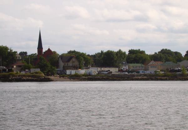
Photo: Decumanus, CC BY-SA 3.0.
Port Richmond is a neighborhood situated on the North Shore of Staten Island, a borough of New York City. Port Richmond is bounded by Kill van Kull on the north, Clove Road on the east, Forest Avenue on the south, and the Bayonne Bridge on the west.
Elm Park
Neighborhood
Elm Park is a small park in the Port Richmond section of Staten Island, one of the five boroughs of New York City, United States. The park is located across Innis Street from Port Richmond High School.
Westerleigh
Neighborhood
Westerleigh is a residential neighborhood in the north-western part of Staten Island in New York City.
Reye’s Deli Mexicana Inc.
- Type: Convenience store
- Categories: shop and food
- Location: Staten Island, New York, Mid-Atlantic, United States, North America
- View on OpenStreetMap
Latitude
40.6365° or 40° 38′ 11″ northLongitude
-74.13461° or 74° 8′ 5″ westOpen location code
87G7JVP8+H5OpenStreetMap ID
node 12988631944OpenStreetMap feature
shop=convenience
This page is based on OpenStreetMap, Wikidata, and Wikimedia Commons.
We’d love your help improving our open data sources. Thank you for contributing.
Satellite Map
Discover Reye’s Deli Mexicana Inc. from above in high-definition satellite imagery.
Notable Places Nearby
Highlights include New York Engine Company 157 and Victory Church in Jesus Christ World Outreach Center.
Nearby Places
Explore places such as Pharmacy Tripharm Drug Inc. and Ria.
New York: Must-Visit Destinations
Delve into New York City, Buffalo, Manhattan, and West Side.
Curious Convenience Stores to Discover
Uncover intriguing convenience stores from every corner of the globe.
About Mapcarta. Data © OpenStreetMap contributors and available under the Open Database License". Text is available under the CC BY-SA 4.0 license, except for photos, directions, and the map. Photo: Jjtkk, Public domain.