Licher Grillhaus
Licher Grillhaus is a fast food restaurant in Lich, Giessen, Hesse. Licher Grillhaus is situated nearby to the town hall Unterstadt 1, as well as near the art gallery Jakobs.| Tap on a place to explore it |
Places of Interest Nearby
Highlights include Unterstadt 1 and Marienstiftskirche.

Marienstiftskirche
Church

Photo: Cherubino, CC BY-SA 3.0.
The Marienstiftskirche is a Lutheran three-aisled hall church in Lich, Middle Hesse, Germany. It was built between 1510 and 1537, making it the last Late Gothic hall church to be built in Hesse.
Schloss Lich
Castle
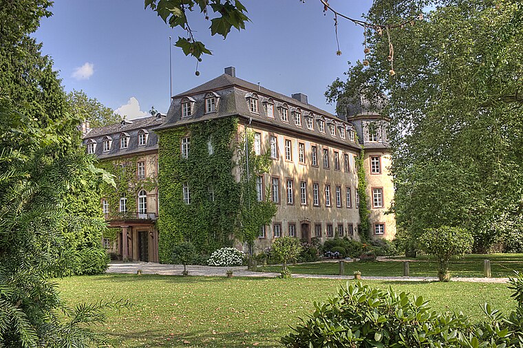
Photo: Steschke, CC BY-SA 3.0 de.
Schloss Lich is a castle, which is situated 180 metres south of Licher Grillhaus.
Places in the Area
Nearby places include Holzheim and Annerod.

Annerod
Village

Photo: Cherubino, CC BY-SA 4.0.
Annerod is a small village, part of the municipality Fernwald, in Germany between Gießen and Großen-Buseck approximately 70 km north of Frankfurt. Annerod has a population of about 3200 people. Annerod is situated 8 km northwest of Licher Grillhaus.
Licher Grillhaus
- Type: Fast food restaurant
- Cuisine: pizza, kebab, salad, burger, and pasta
- Categories: food and restaurant
- Location: Lich, Giessen, North Hesse, Hesse, Germany, Central Europe, Europe
- View on OpenStreetMap
Latitude
50.51987° or 50° 31′ 12″ northLongitude
8.82006° or 8° 49′ 12″ eastOpen location code
9F2CGR9C+W2OpenStreetMap ID
node 13005432237OpenStreetMap feature
amenity=fast_foodOpenStreetMap attribute
cuisine=pizzaOpenStreetMap attribute
cuisine=kebabOpenStreetMap attribute
cuisine=saladOpenStreetMap attribute
cuisine=burgerOpenStreetMap attribute
cuisine=pasta
This page is based on OpenStreetMap, Wikidata, and Wikimedia Commons.
We’d love your help improving our open data sources. Thank you for contributing.
Satellite Map
Discover Licher Grillhaus from above in high-definition satellite imagery.
Notable Places Nearby
Highlights include Jakobs and Heimatmuseum Lich.
Nearby Places
Explore places such as Unger and Sleeves Up.
North Hesse: Must-Visit Destinations
Delve into Kassel, Wetzlar, Marburg, and Fulda.
Curious Fast Food Restaurants to Discover
Uncover intriguing fast food restaurants from every corner of the globe.
About Mapcarta. Data © OpenStreetMap contributors and available under the Open Database License". Text is available under the CC BY-SA 4.0 license, except for photos, directions, and the map. Photo: Kreuzschnabel, CC BY-SA 3.0.