Mírová railway stop
Mírová railway stop is a railway stop in Mírová, Karlovy Vary District, Karlovy Vary Region. Mírová railway stop is situated nearby to the playground dětské hřiště, as well as near the pitch Beach Volleyball.| Tap on a place to explore it |
Places of Interest Nearby
Highlights include Chodov railway station and Church of Saint Lawrence.
Chodov railway station
Railway station
 Chodov railway station is situated 1¼ km southwest of Mírová railway stop.
Church of Saint Lawrence
Church
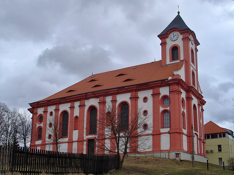
Photo: Ondřej Žváček, CC BY 2.5.
Church of Saint Lawrence is situated 1 km west of Mírová railway stop.
Evangelical church
Church

Photo: Lubor Ferenc, CC BY-SA 4.0.
Evangelical church is situated 1¼ km west of Mírová railway stop.
Places in the Area
Nearby places include Chodov and Božičany.
Chodov
Town

Photo: Lubor Ferenc, CC BY-SA 4.0.
Chodov is a town in Sokolov District in the Karlovy Vary Region of the Czech Republic. It has about 13,000 inhabitants.
Božičany
Village

Photo: Whitesachem, CC BY-SA 4.0.
Božičany is a municipality and village in Karlovy Vary District in the Karlovy Vary Region of the Czech Republic. It has about 600 inhabitants.
Chranišov
Village

Photo: Wikimedia, CC BY-SA 4.0.
Chranišov is a village, part of the municipality of Nové Sedlo, in the Sokolov District of the Karlovy Vary Region of the Czech Republic. It is located to the south of Chodov.
Mírová railway stop
- Type: Railway stop
- Description: railway stop in Mírová, Czech Republic
- Categories: railway station, station, and transportation
- Location: Mírová, Karlovy Vary District, Karlovy Vary Region, Czech Republic, Central Europe, Europe
- View on OpenStreetMap
Latitude
50.23952° or 50° 14′ 22″ northLongitude
12.76387° or 12° 45′ 50″ eastOperator
Správa železnicOpen location code
9F2J6QQ7+RGOpenStreetMap ID
node 13018839356OpenStreetMap feature
public_transport=stationOpenStreetMap feature
railway=haltWikidata ID
Q66888569
This page is based on OpenStreetMap, Wikidata, and Wikimedia Commons.
We’d love your help improving our open data sources. Thank you for contributing.
Satellite Map
Discover Mírová railway stop from above in high-definition satellite imagery.
In Other Languages
From Czech to German—“Mírová railway stop” goes by many names.
- Czech: “Mírová”
- French: “Mírová”
- German: “Haltepunkt Mírová”
- German: “Haltepunkt Münchhof”
- German: “Münchhof”
Notable Places Nearby
Highlights include dětské hřiště and Beach Volleyball.
Nearby Places
Explore places such as Mírová and zahr. osada.
Czech Republic: Must-Visit Destinations
Delve into Prague, Brno, Pilsen, and Ostrava.
Curious Railway Stops to Discover
Uncover intriguing railway stops from every corner of the globe.
About Mapcarta. Data © OpenStreetMap contributors and available under the Open Database License". Text is available under the CC BY-SA 4.0 license, except for photos, directions, and the map. Photo: Mejdlowiki, CC BY-SA 4.0.