Lotissement Pré de l’Étang
Lotissement Pré de l’Étang is a neighborhood in Meunet-sur-Vatan, Arrondissement of Issoudun, Centre-Val de Loire. Lotissement Pré de l’Étang is situated nearby to the locality Le Souillat, as well as near La Planche.| Tap on a place to explore it |
Places in the Area
Nearby places include Vatan and Saint-Florentin.
Vatan
Village
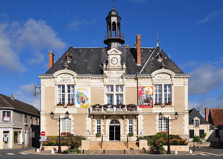
Photo: Wikimedia, CC BY-SA 3.0.
Vatan is a French commune in the Indre department in Centre-Val de Loire region. The town has been labeled Village étape since 1997 and Ville fleurie with 2 flowers. Vatan is situated 4½ km west of Lotissement Pré de l’Étang.
Saint-Florentin
Village
Saint-Florentin is a commune in the Indre department in central France. Saint-Florentin is situated 5 km west of Lotissement Pré de l’Étang.
La Chapelle-Saint-Laurian
Village

Photo: Eurasia21eu, CC BY-SA 3.0.
La Chapelle-Saint-Laurian is a commune in the Indre department in central France. La Chapelle-Saint-Laurian is situated 7 km west of Lotissement Pré de l’Étang.
Lotissement Pré de l’Étang
- Type: Neighborhood
- Category: locality
- Location: Meunet-sur-Vatan, Arrondissement of Issoudun, Indre, Centre-Val de Loire, France, Europe
- View on OpenStreetMap
Latitude
47.08061° or 47° 4′ 50″ northLongitude
1.86811° or 1° 52′ 5″ eastOpen location code
8FV33VJ9+66OpenStreetMap ID
node 13036008708OpenStreetMap feature
place=neighbourhood
This page is based on OpenStreetMap, Wikidata, and Wikimedia Commons.
We’d love your help improving our open data sources. Thank you for contributing.
Satellite Map
Discover Lotissement Pré de l’Étang from above in high-definition satellite imagery.
Localities in the Area
Explore places such as Le Souillat and Pré de l’Étang.
Notable Places Nearby
Highlights include Cimetière and Église Saint-Loup de Meunet-sur-Vatan.
Centre-Val de Loire: Must-Visit Destinations
Delve into Orléans, Tours, Chartres, and Bourges.
Curious Neighborhoods to Discover
Uncover intriguing neighborhoods from every corner of the globe.
About Mapcarta. Data © OpenStreetMap contributors and available under the Open Database License". Text is available under the CC BY-SA 4.0 license, except for photos, directions, and the map. Photo: JLPC, CC BY-SA 3.0.