Ostkreuz City
Ostkreuz City is an office in Berlin, Berlin. Ostkreuz City is situated nearby to the government office Berliner Landeszentrale für politische Bildung, as well as near the health club Every Damn Day Yoga.| Tap on a place to explore it |
Places of Interest Nearby
Highlights include Berlin Ostkreuz station and Annemirl-Bauer-Platz.
Berlin Ostkreuz station
Railway station
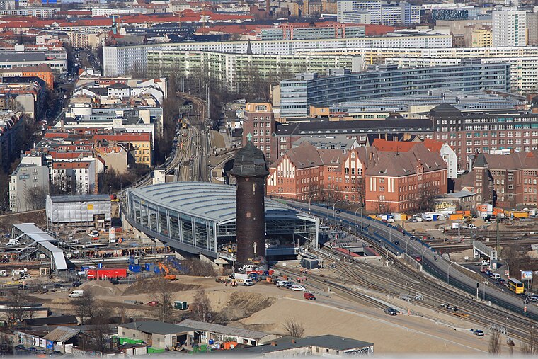
Photo: Wo st 01, CC BY-SA 3.0 de.
Berlin Ostkreuz station is a station on the Berlin S-Bahn suburban railway and the busiest interchange station in Berlin. It is in the former East Berlin district of Friedrichshain, now part of the borough of Friedrichshain-Kreuzberg. Berlin Ostkreuz station is situated 500 metres southeast of Ostkreuz City.
Annemirl-Bauer-Platz
Park

Photo: Wikimedia, CC BY-SA 3.0.
Annemirl-Bauer-Platz is a park, which is situated 260 metres east of Ostkreuz City.
Wühlischplatz
Park

Photo: Nicor, CC BY-SA 2.5.
Wühlischplatz is a park, which is situated 310 metres north of Ostkreuz City.
Places in the Area
Nearby places include Rudolfkiez and Mediaspree.

Mediaspree
Quarter

Photo: Jenny Paul, CC BY-SA 4.0.
Mediaspree is one of the largest property investment projects in Berlin. It aims to establish telecommunication and media companies along a section of the banks of the river Spree as well as to implement an urban renewal of the surrounding area.

Ostkreuz City
- Type: Office
- Location: Berlin, Berlin, Stadt, Berlin, Germany, Central Europe, Europe
- View on OpenStreetMap
Latitude
52.505° or 52° 30′ 18″ northLongitude
13.46287° or 13° 27′ 46″ eastOpen location code
9F4MGF37+X4OpenStreetMap ID
node 13040908918OpenStreetMap feature
office=yes
This page is based on OpenStreetMap, Wikidata, and Wikimedia Commons.
We’d love your help improving our open data sources. Thank you for contributing.
Satellite Map
Discover Ostkreuz City from above in high-definition satellite imagery.
Places with the Same Name
Discover other places named “Ostkreuz City”.
Notable Places Nearby
Highlights include Berliner Landeszentrale für politische Bildung and Every Damn Day Yoga.
Nearby Places
Explore places such as Podigee and Koko & Lores.
Berlin: Must-Visit Destinations
Delve into Mitte, East Central, City West, and East Berlin.
Curious Offices to Discover
Uncover intriguing offices from every corner of the globe.
About Mapcarta. Data © OpenStreetMap contributors and available under the Open Database License". Text is available under the CC BY-SA 4.0 license, except for photos, directions, and the map. Photo: Berthold Werner, CC BY-SA 3.0.