St Moriz Kirche Coburg
St Moriz Kirche Coburg is a church in Coburg, Upper Franconia, Bavaria which is located on Kirchhof. St Moriz Kirche Coburg is situated nearby to the government office Stadt Coburg Bauamt, as well as near the fountain Rückertbrunnen.| Tap on a place to explore it |
Places of Interest Nearby
Highlights include Morizkirche and Landesbibliothek Coburg.
Morizkirche
Church

Photo: PeterBraun74, CC BY-SA 3.0.
Morizkirche is a Protestant church dedicated to Saint Maurice in Coburg, Bavaria, Germany, and is the town's oldest church. Its earliest remaining structures date back to the 14th century, which superseded a church from the 12th century.
Landesbibliothek Coburg
Library

Photo: Störfix, CC BY-SA 3.0.
The Landesbibliothek Coburg is a regional state library under the administration of the Free State of Bavaria. It has its seat in the Ehrenburg Palace in Coburg and brings together the historical book collections of the dukes reigning in Coburg and their relatives. Landesbibliothek Coburg is situated 110 metres northeast of St Moriz Kirche Coburg.
Rathaus
Town hall
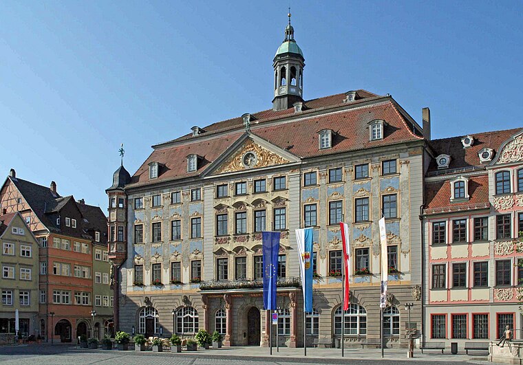
Photo: Störfix, CC BY-SA 3.0.
Rathaus is a town hall, which is situated 140 metres northwest of St Moriz Kirche Coburg.
Places in the Area
Nearby places include Ketschendorf and Festungshof.
Ketschendorf
Suburb

Photo: Störfix, CC BY-SA 3.0 de.
Ketschendorf is a southern suburb of the city of Coburg in the county of Upper Franconia, in the state of Bavaria in Germany.


St Moriz Kirche Coburg
- Type: Church
- Address: Kirchhof 3, Coburg, 96450
- Categories: place of worship and religion
- Location: Coburg, Coburg, Upper Franconia, Franconia, Bavaria, Germany, Central Europe, Europe
- View on OpenStreetMap
Latitude
50.25722° or 50° 15′ 26″ northLongitude
10.96623° or 10° 57′ 58″ eastOpen location code
9F2G7X48+VFOpenStreetMap ID
node 13052501457OpenStreetMap feature
amenity=place_of_worship
This page is based on OpenStreetMap, Wikidata, and Wikimedia Commons.
We’d love your help improving our open data sources. Thank you for contributing.
Satellite Map
Discover St Moriz Kirche Coburg from above in high-definition satellite imagery.
Notable Places Nearby
Highlights include Stadt Coburg Bauamt and Rückertbrunnen.
Nearby Places
Explore places such as Koriander and Motorradparkplatz Kirchplatz.
Upper Franconia: Must-Visit Destinations
Delve into Bamberg, Bayreuth, Hof, and Kulmbach.
Curious Churches to Discover
Uncover intriguing churches from every corner of the globe.
About Mapcarta. Data © OpenStreetMap contributors and available under the Open Database License". Text is available under the CC BY-SA 4.0 license, except for photos, directions, and the map. Photo: Benreis, CC BY 3.0.